Marville - Montmedy Marville
Airport details
| Country | France |
| State | Grand Est |
| Region | LF |
| Airspace | Paris Ctr |
| Municipality | Iré-le-Sec |
| Elevation | 901ft (275m) |
| Timezone | GMT +1 |
| Coordinates | 49.46104, 5.40022 |
| Magnetic var | |
| Type | land |
| Available since | X-Plane v10.40 |
| ICAO code | LFYK |
| IATA code | n/a |
| FAA code | n/a |
Communication
| MontMedy Marville ATC Freq | 123.500 |
Nearby Points of Interest:
Château d'Auflance
-Fanum de Mouzon
-Fortifications de Carignan
-ermitage de Wachet
-Hôtel de ville de Longwy
-Maison de l'Intendance
-city walls of Longwy
-puits couvert de Longwy
-Maisons espagnoles de Mouzon
-Domaine de Clémarais, Aubange
-Hôtel de ville d'Étain
-Sous-préfecture de Verdun
-Immeuble, 27 rue de la Paix
-Maison du Pape Jules II
-Immeuble Noguez
-Porte Châtel
-Remparts de Verdun
-Abbaye Saint-Vanne de Verdun
-Verdun Town Hall
-Pont-écluse Saint-Amand de Verdun
-Butte de Vauquois
-Château de Montvillers
-Château-ferme de Brieulles-sur-Bar
-Nécropole mérovingienne d'Audun-le-Tiche
-Mine de fer Bassompierre
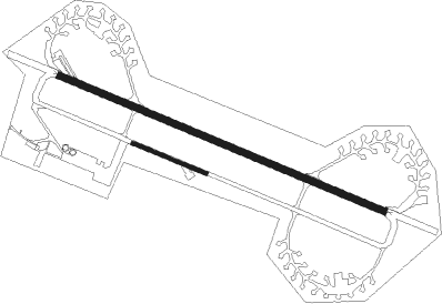
Runway info
Runway 12L / 30R  | ||
| length | 2202m (7224ft) | |
| bearing | 108° / 288° | |
| width | 45m (148ft) | |
| surface | asphalt | |
| Runway 12R / 30L | ||
| length | 501m (1644ft) | |
| bearing | 108° / 288° | |
| width | 23m (75ft) | |
| surface | asphalt | |
| displ threshold | 1m (3ft) / 0m (0ft) | |
Nearby beacons
| code | identifier | dist | bearing | frequency |
|---|---|---|---|---|
| MMD | MONTMEDY VOR | 11.5 | 256° | 109.40 |
| ETN | ETAIN NDB | 17.6 | 130° | 410 |
| WLU | LUXEMBOURG NDB | 26.2 | 81° | 346 |
| LW | LUXEMBOURG NDB | 31.5 | 79° | 404 |
| MTZ | METZ NDB | 33.5 | 103° | 354 |
| LE | LUXEMBOURG NDB | 34.7 | 78° | 318 |
| LUX | LUXEMBOURG VOR/DME | 34.7 | 78° | 112.25 |
| DIK | DIEKIRCH NDB | 37.1 | 61° | 307 |
| ELU | LUXEMBOURG NDB | 39.4 | 77° | 368 |
| LOU | LORRAINE NDB | 44 | 118° | 388 |
| SDI | SAINT DIZIER ROBINSON TACAN | 53.4 | 212° | 114 |
| BFS | FLORENNES TACAN | 55 | 316° | 111.50 |
| NAY | NANCY OCHEY TACAN | 56.9 | 148° | 116.80 |
| GSY | GOSLY (CHARLEROI) VOR/DME | 70.1 | 316° | 115.70 |
Disclaimer
The information on this website is not for real aviation. Use this data with the X-Plane flight simulator only! Data taken with kind consent from X-Plane 12 source code and data files. Content is subject to change without notice.