Pruniers En Sologne - Romorantin Pruniers
Airport details
| Country | France |
| State | Centre-Val de Loire |
| Region | LF |
| Airspace | Paris Ctr |
| Municipality | Pruniers-en-Sologne |
| Elevation | 289ft (88m) |
| Timezone | GMT +1 |
| Coordinates | 47.32084, 1.68889 |
| Magnetic var | |
| Type | land |
| Available since | X-Plane v10.40 |
| ICAO code | LFYR |
| IATA code | n/a |
| FAA code | n/a |
Communication
| Romorantin Pruniers Tower ROMORANTIN | 119.075 |
Nearby Points of Interest:
Usine Matra de Romorantin
-Église Saint-Martin de Marcilly-en-Gault
-Château de La Ferté-Imbault
-théâtre antique de Neung-sur-Beuvron
-Abbaye Saint-Martin de Massay
-château de Rivaulde
-Pontlevoy Abbey
-mur d'enceinte du domaine national de Chambord
-chapelle du château de Chambord
-Pont Saint-Michel
-Ponts Chartrains
-Nançay Radio Telescope
-Hôtel de ville de Blois
-Collégiale Saint-Sauveur de Blois
-Chocolaterie Poulain in Blois
-prieuré Saint-Lazare et hospice Lunier
-Palais de justice de Blois
-Prefecture hotel of Loir-et-Cher
-Château de Colliers
-Mairie de Montrésor
-Tuilerie de la Bretèche
-Abbey at Guiche
-Abbaye de Beaugerais
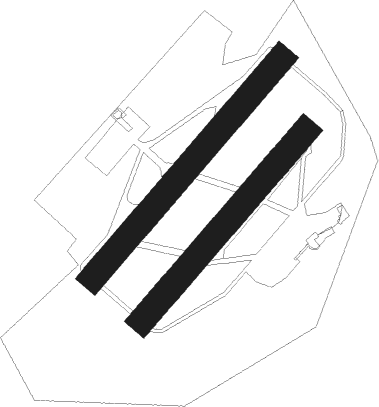
Runway info
Runway 05 / 23  | ||
| length | 559m (1834ft) | |
| bearing | 56° / 236° | |
| width | 10m (33ft) | |
| surface | asphalt | |
| Runway 05R / 23L | ||
| length | 951m (3120ft) | |
| bearing | 56° / 236° | |
| width | 100m (328ft) | |
| surface | grass | |
| Runway 05L / 23R | ||
| length | 1098m (3602ft) | |
| bearing | 56° / 236° | |
| width | 100m (328ft) | |
| surface | grass | |
| displ threshold | 155m (509ft) / 154m (505ft) | |
Nearby beacons
| code | identifier | dist | bearing | frequency |
|---|---|---|---|---|
| CTX | CHATEAUROUX DEOLS NDB | 23.5 | 164° | 428 |
| AMB | AMBOISE VOR/DME | 26.2 | 280° | 113.70 |
| AMB | AMBOISE NDB | 26.9 | 279° | 341 |
| BLB | BLOIS NDB | 28.9 | 306° | 397 |
| BRG | BOURGES NDB | 30.2 | 117° | 375 |
| TUR | TOURS VAL DE LOIRE TACAN | 39.4 | 276° | 113.80 |
| TUR | TOURS VAL DE LOIRE NDB | 39.6 | 285° | 331 |
| BCY | ORLEANS VOR/DME | 39.9 | 6° | 117.35 |
| OAN | ORLEANS-BRICY NDB | 40.9 | 7° | 385 |
| AVD | AVORD TACAN | 41.5 | 106° | 110.60 |
| ORS | ORLEANS SAINT DENIS DE L'HOTEL NDB | 43.2 | 42° | 322 |
| CAD | CHATEAUDUN VOR/DME | 45.9 | 338° | 115.95 |
| CHN | CHATEAUDUN TACAN | 45.9 | 337° | 110.20 |
| PTV | PITHIVIERS VOR | 55.2 | 35° | 116.50 |
Disclaimer
The information on this website is not for real aviation. Use this data with the X-Plane flight simulator only! Data taken with kind consent from X-Plane 12 source code and data files. Content is subject to change without notice.