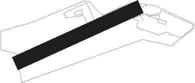
Sainte Léocadie - Sainte Leocadie
Airport details
| Country | France |
| State | Occitania |
| Region | LF |
| Airspace | Bordeaux Ctr |
| Municipality | Sainte-Léocadie |
| Elevation | 4330ft (1320m) |
| Timezone | GMT +1 |
| Coordinates | 42.44720, 2.01111 |
| Magnetic var | |
| Type | land |
| Available since | X-Plane v10.40 |
| ICAO code | LFYS |
| IATA code | n/a |
| FAA code | n/a |
Communication
| Sainte Leocadie INFO | 118.625 |
Nearby Points of Interest:
Sant Guillem de la Prada-Llívia
-House in carrer Forns, 9
-Torre de Bernat de So
-Creu de Toret
-Casa de la Vila de Llívia
-Font de l'església de la Mare de Déu dels Àngels
-Torres de l'Església de Llívia
-Vila de Llívia
-Croix de cimetière d'Ur
-Nostra Senyora de Gràcia de Puigcerdà
-Convent de Sant Domènec
-Casino Ceretà
-Casa Gran
-Building in rambla Josep M. Martí, 1
-Villa Paulita
-Torre Muñoz
-Building in plaça Cabrinetty, 6
-Plaça Cabrinetty
-Obelisc
-Building in plaça Cabrinetty, 16
-Building in carrer Major, 37
-Casa de la Vila
-Can Deulofeu
-Mirador de la Cerdanya
-Safareig de les Monges
Nearby beacons
| code | identifier | dist | bearing | frequency |
|---|---|---|---|---|
| SAL | SAINTE LEOCADIE NDB | 0 | 113° | 418 |
| PPG | PERPIGNAN RIVESALTES VOR/DME | 42 | 71° | 117.20 |
| PL | RIVESALTES (PERPIGNAN) NDB | 42.7 | 76° | 351 |
| PMR | PAMIERS NDB | 42.8 | 327° | 384 |
| GRN | GERONA (GIRONA) NDB | 43.5 | 118° | 412 |
| GIR | GERONA (GIRONA) VOR/DME | 45.8 | 124° | 114.10 |
| G | GIRONA NDB | 46 | 124° | 330 |
| CS | CARCASSONNE SALVAZA NDB | 47.3 | 14° | 345 |
| CLE | CALELLA VOR/DME | 55.8 | 142° | 115.35 |
| SLL | SABADELL VOR/DME | 55.8 | 174° | 112 |
Disclaimer
The information on this website is not for real aviation. Use this data with the X-Plane flight simulator only! Data taken with kind consent from X-Plane 12 source code and data files. Content is subject to change without notice.
