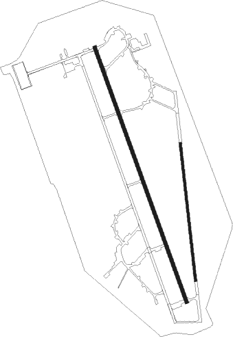
Andravida
Airport details
| Country | Greece |
| State | Peloponnese, Western Greece and the Ioni |
| Region | LG |
| Airspace | Athens Ctr |
| Municipality | Municipality of Andravida and Kyllini |
| Elevation | 55ft (17m) |
| Timezone | GMT +2 |
| Coordinates | 37.92528, 21.29139 |
| Magnetic var | |
| Type | land |
| Available since | X-Plane v10.32 |
| ICAO code | LGAD |
| IATA code | PYR |
| FAA code | n/a |
Communication
| Andravida Tower | 120.650 |
| Andravida Tower | 122.100 |
| Andravida Approach | 120.650 |
| Andravida Approach | 122.100 |
Nearby Points of Interest:
Strofylia forest
-Missolonghi–Aitoliko Lagoons
-Apollon Theatre
-ancient theater of Calydon
Nearby beacons
| code | identifier | dist | bearing | frequency |
|---|---|---|---|---|
| AML | ANDRAVIDA TACAN | 0.4 | 305° | 133.40 |
| AML | AMALIAS NDB | 9.3 | 160° | 367 |
| ARX | ARAXOS TACAN | 15.2 | 31° | 112.40 |
| ARA | ARAXOS VOR/DME | 15.4 | 31° | 112.70 |
| ZAT | ZAKINTHOS NDB | 21.8 | 247° | 326 |
| ZAK | ZAKINTHOS VOR/DME | 22 | 246° | 110.80 |
| KFN | KEFALLINIA VOR/DME | 38.8 | 283° | 115.50 |
| KEF | KEFALLINIA NDB | 38.9 | 283° | 318 |
| KLM | KALAMATA TACAN | 61.6 | 139° | 115.20 |
| KAM | KALAMATA VOR/DME | 62.2 | 140° | 112.60 |
| PAK | PREVEZA NDB | 64.6 | 332° | 353 |
| PRV | PREVEZA TACAN | 64.7 | 332° | 109.20 |
Departure and arrival routes
| Transition altitude | 8000ft |
| SID end points | distance | outbound heading | |
|---|---|---|---|
| RW16L | |||
| TRL1D | 59mi | 116° | |
| KAM1B | 62mi | 140° | |
| ZAK1B | 22mi | 246° | |
| KFN1J | 39mi | 283° | |
Disclaimer
The information on this website is not for real aviation. Use this data with the X-Plane flight simulator only! Data taken with kind consent from X-Plane 12 source code and data files. Content is subject to change without notice.

