Nea Anchialos
Airport details
| Country | Greece |
| State | Thessaly and Central Greece |
| Region | LG |
| Airspace | Athens Ctr |
| Municipality | Almyros Municipality |
| Elevation | 83ft (25m) |
| Timezone | GMT +2 |
| Coordinates | 39.21944, 22.79445 |
| Magnetic var | |
| Type | land |
| Available since | X-Plane v10.40 |
| ICAO code | LGBL |
| IATA code | VOL |
| FAA code | n/a |
Communication
| Nea Anchialos Nea Anchialo Tower | 122.100 |
| Nea Anchialos ALMIROS Approach | 122.100 |
| Nea Anchialos ALMIROS Approach | 120.350 |
Approach frequencies
| ILS-cat-I | RW26 | 110.9 | 18.00mi |
| 2.5° GS | RW26 | 110.9 | 18.00mi |
Nearby Points of Interest:
Phthiotic Thebes
-Pherae
-Antron
-Achinos, Phthiotis
-Gorgopotamos bridge
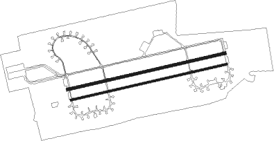
Runway info
Runway 08R / 26L  | ||
| length | 2716m (8911ft) | |
| bearing | 83° / 263° | |
| width | 34m (110ft) | |
| surface | asphalt | |
| blast zone | 238m (781ft) / 255m (837ft) | |
| Runway 08 / 26 | ||
| length | 2756m (9042ft) | |
| bearing | 83° / 263° | |
| width | 45m (148ft) | |
| surface | asphalt | |
| blast zone | 255m (837ft) / 255m (837ft) | |
Nearby beacons
| code | identifier | dist | bearing | frequency |
|---|---|---|---|---|
| AGH | ANCHIALOS VOR/DME | 0.2 | 218° | 110.40 |
| ANL | NEA ANCHIALOS TACAN | 2.3 | 263° | 115.60 |
| STV | STEFANOVIKION VOR | 15.6 | 355° | 112.90 |
| STF | STEFANOVIKION NDB | 15.7 | 355° | 420 |
| LAR | LARISSA TACAN | 29.4 | 327° | 109 |
| LSA | LARISSA NDB | 29.8 | 322° | 362 |
| SKC | SKIATHOS NDB | 32.9 | 94° | 326 |
| SKP | SKOPELOS VOR/DME | 38.3 | 93° | 113.40 |
| TGR | TANAGRA TACAN | 62.2 | 140° | 108.40 |
| TGG | TANAGRA VOR/DME | 63.8 | 139° | 111.80 |
| TNG | TANAGRA NDB | 69.3 | 134° | 303 |
Departure and arrival routes
| Transition altitude | 9000ft |
| SID end points | distance | outbound heading | |
|---|---|---|---|
| RW08 | |||
| EVIK1A | 30mi | 93° | |
| TGG2C | 64mi | 139° | |
| GART1A | 86mi | 263° | |
| LUSE1A | 19mi | 284° | |
| VAXU1A | 17mi | 320° | |
| RW26 | |||
| EVIK1B | 30mi | 93° | |
| TGG2F | 64mi | 139° | |
| GART1B | 86mi | 263° | |
| LUSE1B | 19mi | 284° | |
| VAXU1B | 17mi | 320° | |
| STAR starting points | distance | inbound heading | |
|---|---|---|---|
| RW26 | |||
| GART1H | 86.2 | 83° | |
| PELI1C, PELI1H | 35.9 | 264° | |
| TGG2H, TGG2J | 63.8 | 319° | |
Holding patterns
| STAR name | hold at | type | turn | heading* | altitude | leg | speed limit |
|---|---|---|---|---|---|---|---|
| EVIK1H | AGH | NDB | right | 251 (71)° | 8000ft - 14000ft | 1.0min timed | ICAO rules |
| GART1H | AGH | NDB | right | 251 (71)° | 8000ft - 14000ft | 1.0min timed | ICAO rules |
| LUSE1H | AGH | NDB | right | 251 (71)° | 8000ft - 14000ft | 1.0min timed | ICAO rules |
| PELI1H | AGH | NDB | right | 251 (71)° | 8000ft - 14000ft | 1.0min timed | ICAO rules |
| TGG2H | AGH | NDB | right | 251 (71)° | 8000ft - 14000ft | 1.0min timed | ICAO rules |
| VAXU1H | AGH | NDB | right | 251 (71)° | 8000ft - 14000ft | 1.0min timed | ICAO rules |
| *) magnetic outbound (inbound) holding course | |||||||
Disclaimer
The information on this website is not for real aviation. Use this data with the X-Plane flight simulator only! Data taken with kind consent from X-Plane 12 source code and data files. Content is subject to change without notice.