Elefsina - Elefsis
Airport details
| Country | Greece |
| State | Attica |
| Region | LG |
| Airspace | Athens Ctr |
| Municipality | Municipal Unit of Elefsina |
| Elevation | 143ft (44m) |
| Timezone | GMT +2 |
| Coordinates | 38.06383, 23.55601 |
| Magnetic var | |
| Type | land |
| Available since | X-Plane v10.40 |
| ICAO code | LGEL |
| IATA code | n/a |
| FAA code | n/a |
Communication
| Elefsis Tower | 120.150 |
| Elefsis Tower | 122.100 |
| Elefsis ATHINAI Approach | 119.100 |
| Elefsis ATHINAI Approach | 129.550 |
Approach frequencies
| ILS-cat-I | RW36R | 111.3 | 18.00mi |
| 3° GS | RW36R | 111.3 | 18.00mi |
Nearby Points of Interest:
Phyle
-Moni Phaneromeni
-Queen's Tower
-Livieratos Mansion
-Athens City Hall
-Averof building
-Lapathiotis House
-tempi hotel
-Agii Theodori (Athens)
-Brauroneion
-Chalkotheke
-Old Temple of Athena
-Athens trilogy
-Hall of the Academy of Athens
-Agios Ioannis Theologos (Athens)
-Gasparis house
-Church House
-Palamas house
-Omorfokklisia
-Old Royal Palace
-Sarogleio Mansion
-Mone Asteriou
-Koutouki Cave
-Cadmea of Thebes
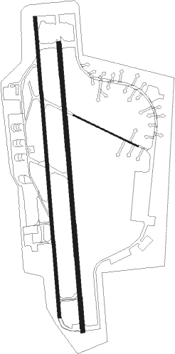
Runway info
Runway 12 / 30  | ||
| length | 678m (2224ft) | |
| bearing | 115° / 295° | |
| width | 15m (49ft) | |
| surface | asphalt | |
| Runway 18R / 36L | ||
| length | 2852m (9357ft) | |
| bearing | 180° / 360° | |
| width | 29m (95ft) | |
| surface | asphalt | |
| displ threshold | 263m (863ft) / 289m (948ft) | |
| Runway 18L / 36R | ||
| length | 2742m (8996ft) | |
| bearing | 180° / 360° | |
| width | 40m (131ft) | |
| surface | asphalt | |
| displ threshold | 0m (0ft) / 64m (210ft) | |
| blast zone | 255m (837ft) / 46m (151ft) | |
Nearby beacons
| code | identifier | dist | bearing | frequency |
|---|---|---|---|---|
| ELF | ELEFSIS TACAN | 0.1 | 60° | 108.20 |
| LEF | ELEFSIS VOR/DME | 0.1 | 139° | 109.85 |
| MGR | MEGARA NDB | 10.5 | 248° | 405 |
| ATV | ATHENS VOR/DME | 15.7 | 125° | 114.40 |
| TGG | TANAGRA VOR/DME | 16.4 | 0° | 111.80 |
| TGR | TANAGRA TACAN | 17.2 | 352° | 108.40 |
| TNG | TANAGRA NDB | 17.7 | 34° | 303 |
| EGN | AIGINA NDB | 18.9 | 204° | 382 |
| SAT | ATHENS VOR/DME | 19.1 | 112° | 109.60 |
| SPA | ATHENS VOR/DME | 20 | 111° | 117.50 |
| KOR | KORINTHOS NDB | 30.4 | 258° | 392 |
| DDM | DIDIMON VOR/DME | 38.7 | 210° | 117.20 |
| KRO | KARISTOS VOR/DME | 44.6 | 94° | 112.20 |
| KEA | KEA VOR/DME | 46.5 | 124° | 115 |
| SKS | SKIROS VOR/DME | 70.2 | 46° | 116.60 |
| SKY | SKYROS TACAN | 70.2 | 46° | 116.10 |
Departure and arrival routes
| Transition altitude | 9000ft |
| SID end points | distance | outbound heading | |
|---|---|---|---|
| RW18L | |||
| ABLO1U | 11mi | 60° | |
| KRO1U | 45mi | 94° | |
| KEA1U | 45mi | 109° | |
| DDM1U | 39mi | 210° | |
| KOR1U | 30mi | 258° | |
| RW18R | |||
| DDM1B, DDM1Q, DDM1X | 39mi | 210° | |
| KOR1X, KOR1Q, KOR1B | 30mi | 258° | |
| RW36L | |||
| DDM1A, DDM1H, DDM1W | 39mi | 210° | |
| KOR1W, KOR1H, KOR1A | 30mi | 258° | |
| RW36R | |||
| ABLO1V | 11mi | 60° | |
| KRO1V | 45mi | 94° | |
| KEA1V | 45mi | 109° | |
| DDM1V | 39mi | 210° | |
| KOR1V | 30mi | 258° | |
| STAR starting points | distance | inbound heading | |
|---|---|---|---|
| RW36L | |||
| DDM1S | 38.7 | 30° | |
| KOR1S | 30.4 | 78° | |
| ROPO1S | 11.7 | 243° | |
Holding patterns
| STAR name | hold at | type | turn | heading* | altitude | leg | speed limit |
|---|---|---|---|---|---|---|---|
| ATV1S | D219N | VHF | right | 39 (219)° | 5000ft - 8000ft | DME 4.0mi | 230 |
| DDM1S | D219N | VHF | right | 39 (219)° | 5000ft - 8000ft | DME 4.0mi | 230 |
| KOR1S | D219N | VHF | right | 39 (219)° | 5000ft - 8000ft | DME 4.0mi | 230 |
| ROPO1S | D219N | VHF | right | 39 (219)° | 5000ft - 8000ft | DME 4.0mi | 230 |
| XORK1S | D219N | VHF | right | 39 (219)° | 5000ft - 8000ft | DME 4.0mi | 230 |
| *) magnetic outbound (inbound) holding course | |||||||
Disclaimer
The information on this website is not for real aviation. Use this data with the X-Plane flight simulator only! Data taken with kind consent from X-Plane 12 source code and data files. Content is subject to change without notice.