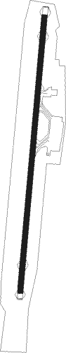
Chios Island - Chios
Airport details
| Country | Greece |
| State | Aegean |
| Region | LG |
| Airspace | Athens Ctr |
| Municipality | Chios Municipality |
| Elevation | 14ft (4m) |
| Timezone | GMT +2 |
| Coordinates | 38.34317, 26.14149 |
| Magnetic var | |
| Type | land |
| Available since | X-Plane v10.40 |
| ICAO code | LGHI |
| IATA code | JKH |
| FAA code | n/a |
Communication
| Chios Tower | 124.000 |
| Chios Tower Departure | 122.700 |
Nearby Points of Interest:
Kambos (Chios)
-Castle of Chios
-Panagia Krina
-Cave Sykia
-Karaburun Peninsula
Nearby beacons
| code | identifier | dist | bearing | frequency |
|---|---|---|---|---|
| HIO | CHIOS NDB | 0.2 | 168° | 299 |
| HOS | CHIOS VOR/DME | 0.3 | 11° | 110.80 |
| MES | MESTA VOR/DME | 12.3 | 249° | 117.60 |
| IKA | IKARIA NDB | 40.8 | 163° | 322 |
| IMR | IZMIR VOR/DME | 40.8 | 92° | 113.70 |
| KLC | KAKLIC TACAN | 40.8 | 78° | 114.15 |
| CIG | CIGLI (IZMIR) TACAN | 41.8 | 80° | 113.60 |
| CIG | CIGLI (IZMIR) NDB | 42.6 | 78° | 363 |
| LVO | MITILINI NDB | 47.7 | 33° | 397 |
| MLN | MITILINI VOR/DME | 47.9 | 33° | 109.60 |
| SAM | SAMOS VOR/DME | 53.5 | 131° | 111.60 |
| SMO | SAMOS NDB | 53.8 | 130° | 375 |
| LSV | LESVOS VOR/DME | 54.9 | 18° | 114.20 |
| MKN | MIKONOS VOR/DME | 66 | 221° | 110 |
| MKO | MIKONOS NDB | 66 | 221° | 401 |
Departure and arrival routes
| Transition altitude | 6000ft |
| SID end points | distance | outbound heading | |
|---|---|---|---|
| RW01 | |||
| PIPE1A | 17mi | 185° | |
| MES1A | 12mi | 249° | |
| PANO1A | 20mi | 275° | |
| MOCN1A | 21mi | 284° | |
| DESU1A | 23mi | 305° | |
| MARI1A | 16mi | 348° | |
| RW19 | |||
| PIPE1B | 17mi | 185° | |
| MES1B | 12mi | 249° | |
| PANO1B | 20mi | 275° | |
| MOCN1B | 21mi | 284° | |
| DESU1B | 23mi | 305° | |
| MARI1B | 16mi | 348° | |
| STAR starting points | distance | inbound heading | |
|---|---|---|---|
| ALL | |||
| PIPE1H | 16.9 | 5° | |
| PANO1H | 20.0 | 95° | |
| MARI1H | 15.6 | 168° | |
Holding patterns
| STAR name | hold at | type | turn | heading* | altitude | leg | speed limit |
|---|---|---|---|---|---|---|---|
| DESU1H | MES | NDB | left | 357 (177)° | 6000ft - 9000ft | 1.0min timed | ICAO rules |
| MARI1H | MES | NDB | left | 357 (177)° | 6000ft - 9000ft | 1.0min timed | ICAO rules |
| MOCN1H | MES | NDB | left | 357 (177)° | 6000ft - 9000ft | 1.0min timed | ICAO rules |
| PANO1H | MES | NDB | left | 357 (177)° | 6000ft - 9000ft | 1.0min timed | ICAO rules |
| PIPE1H | MES | NDB | left | 357 (177)° | 6000ft - 9000ft | 1.0min timed | ICAO rules |
| *) magnetic outbound (inbound) holding course | |||||||
Disclaimer
The information on this website is not for real aviation. Use this data with the X-Plane flight simulator only! Data taken with kind consent from X-Plane 12 source code and data files. Content is subject to change without notice.