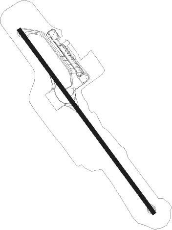
Kos Island - Kos Ippokratis
Airport details
| Country | Greece |
| State | Aegean |
| Region | LG |
| Airspace | Athens Ctr |
| Municipality | Municipality of Kos |
| Elevation | 412ft (126m) |
| Timezone | GMT +2 |
| Coordinates | 36.79472, 27.09111 |
| Magnetic var | |
| Type | land |
| Available since | X-Plane v10.40 |
| ICAO code | LGKO |
| IATA code | KGS |
| FAA code | n/a |
Communication
| Kos Ippokratis ATIS | 126.950 |
| Kos Ippokratis Ground Control | 121.775 |
| Kos Ippokratis IPPOKRATIS Tower | 121.050 |
| Kos Ippokratis IPPOKRATIS Tower | 122.100 |
| Kos Ippokratis KOS Approach | 119.950 |
| Kos Ippokratis KOS Approach | 122.100 |
Nearby beacons
| code | identifier | dist | bearing | frequency |
|---|---|---|---|---|
| KOS | KOS NDB | 0.2 | 279° | 311 |
| LRO | LEROS NDB | 27.1 | 323° | 419 |
| ATL | ASTYPALAIA NDB | 36.7 | 253° | 422 |
| BDR | MILAS BODRUM NDB | 38.2 | 50° | 389 |
| PAR | RODOS VOR/DME | 52.6 | 112° | 108.60 |
| SMO | SAMOS NDB | 54.1 | 349° | 375 |
| SAM | SAMOS VOR/DME | 54.2 | 348° | 111.60 |
| RDS | RODOS VOR/DME | 55 | 115° | 115.80 |
| IKA | IKARIA NDB | 64.1 | 320° | 322 |
Departure and arrival routes
| Transition altitude | 5000ft |
| SID end points | distance | outbound heading | |
|---|---|---|---|
| RW14 | |||
| RDS3B | 55mi | 115° | |
| GILO1C | 21mi | 212° | |
| KOPA1F, KOPA3B, KOPA3C | 19mi | 275° | |
| LARK3B, LARK1F | 38mi | 337° | |
| RW32 | |||
| GILO1A, GILO1D | 21mi | 212° | |
| KOPA3A | 19mi | 275° | |
| LARK3A | 38mi | 337° | |
| STAR starting points | distance | inbound heading | |
|---|---|---|---|
| RW14 | |||
| GILO1H, GILO1J, GILO1N | 20.6 | 32° | |
| KOPA2J, KOPA1N, KOPA2H | 19.4 | 95° | |
| LARK2H | 38.2 | 157° | |
| CODI1J | 36.6 | 297° | |
| RW32 | |||
| GILO1K, GILO1L, GILO1M | 20.6 | 32° | |
| KOPA2L, KOPA2K, KOPA1M | 19.4 | 95° | |
| LARK2K, LARK2L | 38.2 | 157° | |
Instrument approach procedures
| runway | airway (heading) | route (dist, bearing) |
|---|---|---|
| RW14 | BATRI (116°) | BATRI 4000ft INFUR (6mi, 62°) 3500ft |
| RNAV | INFUR 3500ft KO141 (4mi, 142°) 3000ft LGKO (8mi, 142°) 462ft KO142 (4mi, 142°) LECOK (13mi, 261°) 3000ft LECOK (turn) 3000ft | |
| RW32 | MORIX (349°) | MORIX 4000ft ELTAK (5mi, 73°) 3500ft |
| RNAV | ELTAK 3500ft KO324 (5mi, 322°) 2500ft LGKO (7mi, 322°) 423ft KO326 (4mi, 322°) LECOK (12mi, 229°) 3000ft LECOK (turn) 3000ft |
Holding patterns
| STAR name | hold at | type | turn | heading* | altitude | leg | speed limit |
|---|---|---|---|---|---|---|---|
| GILO1H | KOS | NDB | right | 297 (117)° | 4000ft - 14000ft | 1.0min timed | 230 |
| GILO1K | KOS | NDB | right | 297 (117)° | 4000ft - 14000ft | 1.0min timed | 230 |
| GILO1M | MORIX | VHF | left | 265 (85)° | > 4000ft | 1.0min timed | 185 |
| GILO1N | BATRI | VHF | right | 185 (5)° | > 4000ft | 1.0min timed | 185 |
| KOPA1M | MORIX | VHF | left | 265 (85)° | > 4000ft | 1.0min timed | 185 |
| KOPA1N | BATRI | VHF | right | 185 (5)° | > 4000ft | 1.0min timed | 185 |
| KOPA2H | KOS | NDB | right | 297 (117)° | 4000ft - 14000ft | 1.0min timed | 230 |
| KOPA2K | KOS | NDB | right | 297 (117)° | 4000ft - 14000ft | 1.0min timed | 230 |
| LARK2H | KOS | NDB | right | 297 (117)° | 4000ft - 14000ft | 1.0min timed | 230 |
| LARK2K | KOS | NDB | right | 297 (117)° | 4000ft - 14000ft | 1.0min timed | 230 |
| USIN1M | MORIX | VHF | left | 265 (85)° | > 4000ft | 1.0min timed | 185 |
| USIN1N | BATRI | VHF | right | 185 (5)° | > 4000ft | 1.0min timed | 185 |
| USIN2H | KOS | NDB | right | 297 (117)° | 4000ft - 14000ft | 1.0min timed | 230 |
| USIN2K | KOS | NDB | right | 297 (117)° | 4000ft - 14000ft | 1.0min timed | 230 |
| *) magnetic outbound (inbound) holding course | |||||||
Disclaimer
The information on this website is not for real aviation. Use this data with the X-Plane flight simulator only! Data taken with kind consent from X-Plane 12 source code and data files. Content is subject to change without notice.
