Karpathos Island - Karpathos
Airport details
| Country | Greece |
| State | Aegean |
| Region | LG |
| Airspace | Athens Ctr |
| Municipality | Municipality of Karpathos |
| Elevation | 64ft (20m) |
| Timezone | GMT +2 |
| Coordinates | 35.42111, 27.14583 |
| Magnetic var | |
| Type | land |
| Available since | X-Plane v10.40 |
| ICAO code | LGKP |
| IATA code | AOK |
| FAA code | n/a |
Communication
| Karpathos INFO | 123.200 |
| Karpathos INFO | 122.100 |
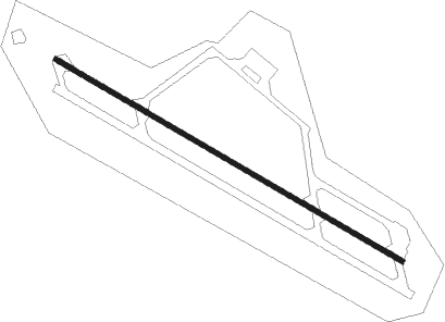
Runway info
| Runway 12 / 30 | ||
| length | 2393m (7851ft) | |
| bearing | 119° / 299° | |
| width | 30m (98ft) | |
| surface | asphalt | |
| displ threshold | 150m (492ft) / 150m (492ft) | |
| blast zone | 255m (837ft) / 140m (459ft) | |
Nearby beacons
| code | identifier | dist | bearing | frequency |
|---|---|---|---|---|
| KPC | KARPATHOS VOR/DME | 0 | 57° | 111.40 |
| KRC | KARPATHOS NDB | 0.2 | 108° | 314 |
| KAO | KASSOS NDB | 11.3 | 270° | 333 |
| SIT | SITIA VOR/DME | 51.4 | 250° | 113.30 |
| RDS | RODOS VOR/DME | 71.5 | 46° | 115.80 |
| PAR | RODOS VOR/DME | 73.8 | 43° | 108.60 |
Departure and arrival routes
| Transition altitude | 6000ft |
| SID end points | distance | outbound heading | |
|---|---|---|---|
| RW12 | |||
| ROXO1B | 27mi | 46° | |
| NIPI1B | 29mi | 136° | |
| LIAK1B | 18mi | 172° | |
| SIT1B | 51mi | 250° | |
| TIPA1B | 35mi | 322° | |
| SOTI1B | 29mi | 331° | |
| RW30 | |||
| ROXO1A | 27mi | 46° | |
| NIPI1A | 29mi | 136° | |
| LIAK1A | 18mi | 172° | |
| SIT1A | 51mi | 250° | |
| TIPA1A | 35mi | 322° | |
| SOTI1A | 29mi | 331° | |
Disclaimer
The information on this website is not for real aviation. Use this data with the X-Plane flight simulator only! Data taken with kind consent from X-Plane 12 source code and data files. Content is subject to change without notice.