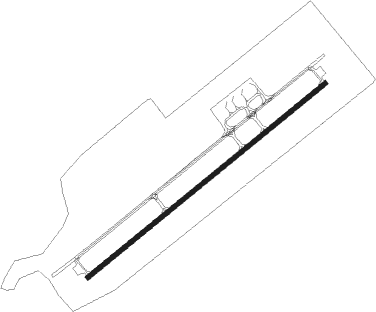
Kavala - Megas Alexandros
Airport details
| Country | Greece |
| State | Macedonia and Thrace |
| Region | LG |
| Airspace | Athens Ctr |
| Municipality | Nestos Municipality |
| Elevation | 18ft (5m) |
| Timezone | GMT +2 |
| Coordinates | 40.91389, 24.61972 |
| Magnetic var | |
| Type | land |
| Available since | X-Plane v10.40 |
| ICAO code | LGKV |
| IATA code | KVA |
| FAA code | n/a |
Communication
| Megas Alexandros Megas Alexandros Atis | 128.150 |
| Megas Alexandros Megas Alexandros Tower | 118.400 |
| Megas Alexandros Megas Alexandros Approach | 124.650 |
| Megas Alexandros Megas Alexandros Approach | 122.100 |
Nearby Points of Interest:
Pistyros
-Lazarist Monastery, Kavala
-Anaktoropolis
-Saint Nicholas Church, Eleftheroupoli
-Clock Tower of Xanthi
-Arap Mosque, Drama
-Archangels Church, Drama
-Saint Sophia Church, Drama
-Herman Spierer Tobacco Warehouse
-Portokaloglou Tobacco Warehouse
-Tzimou Mansion
Nearby beacons
| code | identifier | dist | bearing | frequency |
|---|---|---|---|---|
| KPL | KAVALA VOR/DME | 0.2 | 256° | 108.80 |
| KHR | KAVALA NDB | 0.9 | 45° | 327 |
| ROZ | DME | 47.3 | 9° | 115.15 |
| LIO | LIMNOS NDB | 65.8 | 148° | 429 |
| LMO | LIMNOS VOR/DME | 66 | 148° | 109.20 |
Departure and arrival routes
| Transition altitude | 7000ft |
| SID end points | distance | outbound heading | |
|---|---|---|---|
| RW05 | |||
| SOSU1N, SOSU1B, SOSU1A | 23mi | 111° | |
| AMAL1A, AMAL1B, AMAL1N | 23mi | 148° | |
| ASKO1A, ASKO1N, ASKO1B | 23mi | 232° | |
| XERI1A, XERI1N | 26mi | 297° | |
| RW23 | |||
| SOSU1L, SOSU1D, SOSU1C | 23mi | 111° | |
| AMAL1L, AMAL1D, AMAL1C | 23mi | 148° | |
| ASKO1C, ASKO1E, ASKO1L | 23mi | 232° | |
| XERI1C, XERI1L | 26mi | 297° | |
| STAR starting points | distance | inbound heading | |
|---|---|---|---|
| RW05 | |||
| ASKO1Z | 22.9 | 52° | |
| LOPT1Z | 18.8 | 147° | |
| SOSU1Z | 22.9 | 291° | |
| AMAL1X, AMAL1Z | 22.8 | 328° | |
| RW23 | |||
| ASKO1Z | 22.9 | 52° | |
| LOPT1Z | 18.8 | 147° | |
| SOSU1Z | 22.9 | 291° | |
| AMAL1Z | 22.8 | 328° | |
Holding patterns
| STAR name | hold at | type | turn | heading* | altitude | leg | speed limit |
|---|---|---|---|---|---|---|---|
| AMAL1H | KPL | NDB | right | 89 (269)° | 6000ft - 60000ft | 1.0min timed | ICAO rules |
| AMAL1J | KPL | NDB | right | 89 (269)° | 6000ft - 60000ft | 1.0min timed | ICAO rules |
| AMAL1Z | KHR | FIX | right | 100 (280)° | 6000ft - 60000ft | 1.0min timed | ICAO rules |
| ASKO1H | KPL | NDB | right | 89 (269)° | 6000ft - 60000ft | 1.0min timed | ICAO rules |
| ASKO1J | KPL | NDB | right | 89 (269)° | 6000ft - 60000ft | 1.0min timed | ICAO rules |
| ASKO1Z | KHR | FIX | right | 100 (280)° | 6000ft - 60000ft | 1.0min timed | ICAO rules |
| LOPT1H | KPL | NDB | right | 89 (269)° | 6000ft - 60000ft | 1.0min timed | ICAO rules |
| LOPT1J | KPL | NDB | right | 89 (269)° | 6000ft - 60000ft | 1.0min timed | ICAO rules |
| LOPT1Z | KHR | FIX | right | 100 (280)° | 6000ft - 60000ft | 1.0min timed | ICAO rules |
| SOSU1H | KPL | NDB | right | 89 (269)° | 6000ft - 60000ft | 1.0min timed | ICAO rules |
| SOSU1J | KPL | NDB | right | 89 (269)° | 6000ft - 60000ft | 1.0min timed | ICAO rules |
| SOSU1Z | KHR | FIX | right | 100 (280)° | 6000ft - 60000ft | 1.0min timed | ICAO rules |
| *) magnetic outbound (inbound) holding course | |||||||
Disclaimer
The information on this website is not for real aviation. Use this data with the X-Plane flight simulator only! Data taken with kind consent from X-Plane 12 source code and data files. Content is subject to change without notice.