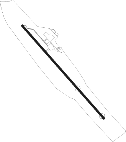
Kozani - Filippos
Airport details
| Country | Greece |
| State | Epirus and Western Macedonia |
| Region | LG |
| Airspace | Athens Ctr |
| Municipality | Κοζάνη |
| Elevation | 2059ft (628m) |
| Timezone | GMT +2 |
| Coordinates | 40.29086, 21.83920 |
| Magnetic var | |
| Type | land |
| Available since | X-Plane v10.40 |
| ICAO code | LGKZ |
| IATA code | KZI |
| FAA code | n/a |
Communication
| Filippos KOZANI AFIS | 118.200 |
Nearby Points of Interest:
Saint Nicholas Church, Velvento
-Poulkos Mansion
-Zavordas Monastery
-Assumption of Mary Church, Torniki
-Medrese Mosque
-Barbouta
-Annunciation Church, Veria
-Saint George the Small Church, Veria
-Berroea
-St. John the Evangelist, Veria
-Saint Nicholas of Gourna Church
-Naousa Clock Tower
-Saint Menas School, Naousa
-Dormition of Mary Church, Naousa
-Chatzimalousis Mansion
-Saint George Church, Naousa
-Saint George Church in Korisos, 19th Century
-Aigai
-Mount Olympus
-Dispilio Neolithic Settlement
-Panagia Olympiotissa Monastery
-Saint Mary Kondariotissa Church
-Doltso
Nearby beacons
| code | identifier | dist | bearing | frequency |
|---|---|---|---|---|
| KZN | KOZANI NDB | 0.1 | 123° | 291 |
| KOZ | KOZANI VOR/DME | 0.3 | 168° | 109.60 |
| KSO | KASTORIA NDB | 27.2 | 285° | 372 |
| KAS | KASTORIA VOR/DME | 27.5 | 286° | 114.50 |
| AXE | ALEXANDRIA VOR | 36.8 | 62° | 110.60 |
| GDA | ALEXANDRIA NDB | 36.9 | 62° | 394 |
| LSA | LARISSA NDB | 48.2 | 136° | 362 |
| LAR | LARISSA TACAN | 48.9 | 133° | 109 |
| STF | STEFANOVIKION NDB | 64.8 | 131° | 420 |
| STV | STEFANOVIKION VOR | 64.9 | 131° | 112.90 |
Departure and arrival routes
| Transition altitude | 9000ft |
| SID end points | distance | outbound heading | |
|---|---|---|---|
| RW14 | |||
| KOGI1B | 13mi | 137° | |
| GOVO1B | 13mi | 285° | |
| RW32 | |||
| KOGI1A | 13mi | 137° | |
| GOVO1A | 13mi | 285° | |
| STAR starting points | distance | inbound heading | |
|---|---|---|---|
| ALL | |||
| GOVO1C | 12.8 | 105° | |
| KOGI1C | 12.5 | 317° | |
Holding patterns
| STAR name | hold at | type | turn | heading* | altitude | leg | speed limit |
|---|---|---|---|---|---|---|---|
| GOVO1C | KOZ | NDB | left | 323 (143)° | 9000ft - 10000ft | 1.0min timed | 230 |
| KOGI1C | KOZ | NDB | left | 323 (143)° | 9000ft - 10000ft | 1.0min timed | 230 |
| *) magnetic outbound (inbound) holding course | |||||||
Disclaimer
The information on this website is not for real aviation. Use this data with the X-Plane flight simulator only! Data taken with kind consent from X-Plane 12 source code and data files. Content is subject to change without notice.
