Larisa - Larissa
Airport details
| Country | Greece |
| State | Thessaly and Central Greece |
| Region | LG |
| Airspace | Athens Ctr |
| Municipality | Larissa |
| Elevation | 241ft (73m) |
| Timezone | GMT +2 |
| Coordinates | 39.64867, 22.44867 |
| Magnetic var | |
| Type | land |
| Available since | X-Plane v10.40 |
| ICAO code | LGLR |
| IATA code | LRA |
| FAA code | n/a |
Communication
| Larissa Tower | 120.550 |
| Larissa Tower | 122.100 |
| Larissa Approach | 120.550 |
| Larissa Approach | 122.100 |
Nearby Points of Interest:
Ottoman baths of Tyrnavos
-Monastery of Komnenion
-Panagia Olympiotissa Monastery
-Pherae
-Mount Olympus
-Phthiotic Thebes
-Saint Nicholas Church, Litochoro
-Saint Marina Church, Litochoro
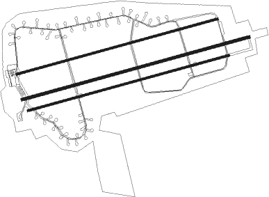
Runway info
Runway 08 / 26  | ||
| length | 3632m (11916ft) | |
| bearing | 82° / 262° | |
| width | 45m (148ft) | |
| surface | asphalt | |
| displ threshold | 154m (505ft) / 150m (492ft) | |
| blast zone | 255m (837ft) / 255m (837ft) | |
| Runway 08R / 26L | ||
| length | 3220m (10564ft) | |
| bearing | 82° / 262° | |
| width | 30m (98ft) | |
| surface | asphalt | |
| displ threshold | 266m (873ft) / 380m (1247ft) | |
| blast zone | 0m (0ft) / 255m (837ft) | |
| Runway 08L / 26R | ||
| length | 3216m (10551ft) | |
| bearing | 82° / 262° | |
| width | 30m (98ft) | |
| surface | concrete | |
| displ threshold | 266m (873ft) / 875m (2871ft) | |
| blast zone | 0m (0ft) / 4m (13ft) | |
Nearby beacons
| code | identifier | dist | bearing | frequency |
|---|---|---|---|---|
| LSA | LARISSA NDB | 0.6 | 105° | 362 |
| LAR | LARISSA TACAN | 2.8 | 82° | 109 |
| STF | STEFANOVIKION NDB | 17.9 | 118° | 420 |
| STV | STEFANOVIKION VOR | 18.1 | 117° | 112.90 |
| ANL | NEA ANCHIALOS TACAN | 29.5 | 146° | 115.60 |
| AGH | ANCHIALOS VOR/DME | 30.4 | 142° | 110.40 |
| KOZ | KOZANI VOR/DME | 47.3 | 316° | 109.60 |
| KZN | KOZANI NDB | 47.5 | 317° | 291 |
| TSL | THESSALONIKI VOR/DME | 54.5 | 34° | 112.10 |
| MKR | MIKRA (THESSALONIKI) VOR/DME | 57.4 | 31° | 110.80 |
| AXE | ALEXANDRIA VOR | 59.8 | 3° | 110.60 |
| GDA | ALEXANDRIA NDB | 59.9 | 3° | 394 |
| THS | THESSALONIKI NDB | 61.2 | 28° | 345 |
Disclaimer
The information on this website is not for real aviation. Use this data with the X-Plane flight simulator only! Data taken with kind consent from X-Plane 12 source code and data files. Content is subject to change without notice.