Megara
Airport details
| Country | Greece |
| State | Attica |
| Region | LG |
| Airspace | Athens Ctr |
| Municipality | Municipal Unit of Megara |
| Elevation | 12ft (4m) |
| Timezone | GMT +2 |
| Coordinates | 37.98139, 23.36611 |
| Magnetic var | |
| Type | land |
| Available since | X-Plane v10.40 |
| ICAO code | LGMG |
| IATA code | n/a |
| FAA code | n/a |
Communication
| Megara Tower | 123.500 |
Nearby Points of Interest:
Moni Phaneromeni
-Phyle
-Brauroneion
-Chalkotheke
-Old Temple of Athena
-Athens City Hall
-tempi hotel
-Agios Ioannis Theologos (Athens)
-Queen's Tower
-Livieratos Mansion
-Gasparis house
-Church House
-Agii Theodori (Athens)
-Averof building
-Palamas house
-Athens trilogy
-Hall of the Academy of Athens
-Lapathiotis House
-Old Royal Palace
-Sarogleio Mansion
-Omorfokklisia
-Cadmea of Thebes
-Mone Asteriou
-Koutouki Cave
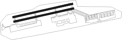
Runway info
Runway 08L / 26R  | ||
| length | 1206m (3957ft) | |
| bearing | 84° / 264° | |
| width | 38m (125ft) | |
| surface | asphalt | |
| blast zone | 60m (197ft) / 50m (164ft) | |
| Runway 08R / 26L | ||
| length | 1206m (3957ft) | |
| bearing | 84° / 264° | |
| width | 38m (125ft) | |
| surface | asphalt | |
Nearby beacons
| code | identifier | dist | bearing | frequency |
|---|---|---|---|---|
| MGR | MEGARA NDB | 0.4 | 276° | 405 |
| LEF | ELEFSIS VOR/DME | 10.2 | 67° | 109.85 |
| ELF | ELEFSIS TACAN | 10.4 | 66° | 108.20 |
| EGN | AIGINA NDB | 13.2 | 164° | 382 |
| KOR | KORINTHOS NDB | 20.6 | 263° | 392 |
| ATV | ATHENS VOR/DME | 21.4 | 102° | 114.40 |
| TGG | TANAGRA VOR/DME | 23.2 | 28° | 111.80 |
| TGR | TANAGRA TACAN | 23.2 | 22° | 108.40 |
| SAT | ATHENS VOR/DME | 26.2 | 97° | 109.60 |
| TNG | TANAGRA NDB | 26.9 | 47° | 303 |
| SPA | ATHENS VOR/DME | 27.3 | 96° | 117.50 |
| DDM | DIDIMON VOR/DME | 31 | 196° | 117.20 |
| KEA | KEA VOR/DME | 51 | 114° | 115 |
Disclaimer
The information on this website is not for real aviation. Use this data with the X-Plane flight simulator only! Data taken with kind consent from X-Plane 12 source code and data files. Content is subject to change without notice.