Csákvár
Airport details
| Country | Hungary |
| State | Fejér |
| Region | |
| Airspace | Budapest Ctr |
| Municipality | Csákvár |
| Elevation | 1000ft (305m) |
| Timezone | GMT +1 |
| Coordinates | 47.36284, 18.43763 |
| Magnetic var | |
| Type | land |
| Available since | X-Plane v11.51r1 |
| ICAO code | LH58 |
| IATA code | n/a |
| FAA code | n/a |
Communication
Nearby Points of Interest:
Vértesi Tájvédelmi Körzet
-Velencei madárrezervátum
-Sárvíz-völgye Tájvédelmi Körzet
-Béla király 20, Frivaldszky Villa
-Balatonkenesei Tátorjános
-Kútvölgyi Úti Oktatókórház
-Saint Catherine of Alexandria Church, Tabán
-Bécsi út, 56
-Hungária Mill
-Semmelweis University Józsefvárosi Clinical Complex
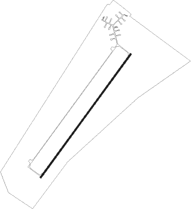
Runway info
| Runway 04 / 22 | ||
| length | 2048m (6719ft) | |
| bearing | 52° / 232° | |
| width | 19m (62ft) | |
| surface | concrete | |
| blast zone | 20m (66ft) / 20m (66ft) | |
Nearby beacons
| code | identifier | dist | bearing | frequency |
|---|---|---|---|---|
| PTB | PUSZTASZABOLCS VOR/DME | 17.7 | 125° | 117.10 |
| BUD | BUDAPEST VOR/DME | 33.4 | 84° | 117.30 |
| GYR | GYOR VOR/DME | 33.9 | 293° | 115.10 |
| SVR | SAGVAR VOR/DME | 34.6 | 211° | 117.70 |
| PC | PAPA NDB | 37.2 | 267° | 318 |
| P | PAPA NDB | 37.7 | 269° | 493 |
| C | PAPA NDB | 38.5 | 271° | 493 |
| PCT | PAPA VORTAC | 38.5 | 271° | 114.75 |
| CP | PAPA NDB | 39.1 | 273° | 318 |
| MNR | MONOR VOR/DME | 39.4 | 92° | 112.50 |
| NIT | NITRA VOR/DME | 57.8 | 337° | 116.50 |
| JAN | JANOVCE VOR/DME | 60.8 | 312° | 110.80 |
Disclaimer
The information on this website is not for real aviation. Use this data with the X-Plane flight simulator only! Data taken with kind consent from X-Plane 12 source code and data files. Content is subject to change without notice.