Székesfehérvár - Börgönd
Airport details
| Country | Hungary |
| State | Fejér |
| Region | LH |
| Airspace | Budapest Ctr |
| Municipality | Székesfehérvár |
| Elevation | 399ft (122m) |
| Timezone | GMT +1 |
| Coordinates | 47.13003, 18.50036 |
| Magnetic var | |
| Type | land |
| Available since | X-Plane v11.20 |
| ICAO code | LHBD |
| IATA code | n/a |
| FAA code | n/a |
Communication
| Börgönd Alba INFO | 119.550 |
Nearby Points of Interest:
Velencei madárrezervátum
-Sárvíz-völgye Tájvédelmi Körzet
-Vértesi Tájvédelmi Körzet
-Balatonkenesei Tátorjános
-Upper Kiskunság alkaline steppes
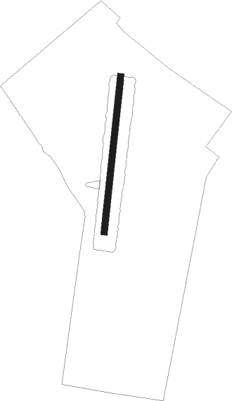
Runway info
| Runway 01 / 19 | ||
| length | 1202m (3944ft) | |
| bearing | 15° / 195° | |
| width | 50m (164ft) | |
| surface | grass | |
Nearby beacons
| code | identifier | dist | bearing | frequency |
|---|---|---|---|---|
| PTB | PUSZTASZABOLCS VOR/DME | 9.9 | 85° | 117.10 |
| SVR | SAGVAR VOR/DME | 23.9 | 232° | 117.70 |
| BUD | BUDAPEST VOR/DME | 36 | 67° | 117.30 |
| MNR | MONOR VOR/DME | 38.9 | 77° | 112.50 |
| PC | PAPA NDB | 41.3 | 281° | 318 |
| P | PAPA NDB | 42.3 | 282° | 493 |
| TPS | TAPIOSAP VOR/DME | 44.2 | 69° | 115.90 |
| GYR | GYOR VOR/DME | 44.7 | 304° | 115.10 |
Disclaimer
The information on this website is not for real aviation. Use this data with the X-Plane flight simulator only! Data taken with kind consent from X-Plane 12 source code and data files. Content is subject to change without notice.