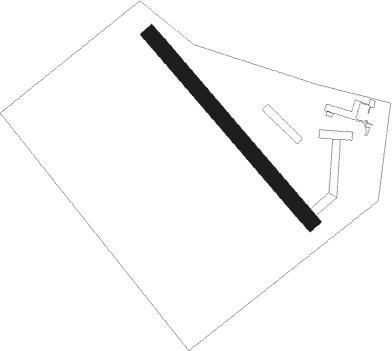
Dunaújváros
Airport details
| Country | Hungary |
| State | Fejér |
| Region | LH |
| Airspace | Budapest Ctr |
| Municipality | Baracs |
| Elevation | 401ft (122m) |
| Timezone | GMT +1 |
| Coordinates | 46.89929, 18.91014 |
| Magnetic var | |
| Type | land |
| Available since | X-Plane v10.40 |
| ICAO code | LHDV |
| IATA code | n/a |
| FAA code | n/a |
Communication
| Dunaújváros Dunaújváros INFO | 130.800 |
Nearby Points of Interest:
Upper Kiskunság alkaline steppes
-Sárvíz-völgye Tájvédelmi Körzet
-Velencei madárrezervátum
-Ócsa Protected Landscape Area
Nearby beacons
| code | identifier | dist | bearing | frequency |
|---|---|---|---|---|
| PTB | PUSZTASZABOLCS VOR/DME | 16.6 | 326° | 117.10 |
| NT | KECSKEMET NDB | 31.9 | 87° | 313 |
| SVR | SAGVAR VOR/DME | 32.8 | 265° | 117.70 |
| MNR | MONOR VOR/DME | 33 | 49° | 112.50 |
| N | KECSKEMET NDB | 33.4 | 88° | 440 |
| KET | KECSKEMET VORTAC | 33.5 | 88° | 114.15 |
| BUG | BUGAC VOR/DME | 34.4 | 106° | 113.40 |
| T | KECSKEMET NDB | 35.4 | 90° | 440 |
| BUD | BUDAPEST VOR/DME | 35.8 | 32° | 117.30 |
| TN | KECSKEMET NDB | 36.7 | 90° | 313 |
| TPS | TAPIOSAP VOR/DME | 41.8 | 42° | 115.90 |
| PP | POGANY (PECS) NDB | 60.5 | 217° | 412 |
Disclaimer
The information on this website is not for real aviation. Use this data with the X-Plane flight simulator only! Data taken with kind consent from X-Plane 12 source code and data files. Content is subject to change without notice.