Kecskemét - Kecskemét (titán)
Airport details
| Country | Hungary |
| State | Bács-Kiskun |
| Region | LH |
| Airspace | Budapest Ctr |
| Municipality | Kecskemét |
| Elevation | 375ft (114m) |
| Timezone | GMT +1 |
| Coordinates | 46.91386, 19.74863 |
| Magnetic var | |
| Type | land |
| Available since | X-Plane v10.40 |
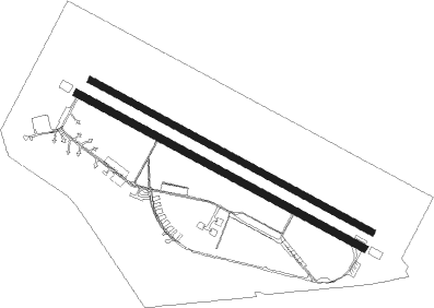
| ICAO code | LHKE |
| IATA code | n/a |
| FAA code | n/a |
Communication
| Kecskemét (Titán) Ground Control | 121.750 |
| Kecskemét (Titán) Tower | 135.750 |
| Kecskemét (Titán) Approach | 120.250 |
Approach frequencies
| ILS-cat-I | RW30 | 109.95 | 18.00mi |
| ILS-cat-I | RW12 | 111.3 | 18.00mi |
| 3° GS | RW30 | 109.95 | 18.00mi |
| 3° GS | RW12 | 111.3 | 18.00mi |
Nearby Points of Interest:
Kecskemét City Hall
-Upper Kiskunság alkaline steppes

Nearby beacons
| code | identifier | dist | bearing | frequency |
|---|---|---|---|---|
| KET | KECSKEMET VORTAC | 1.1 | 301° | 114.15 |
| T | KECSKEMET NDB | 1.1 | 106° | 440 |
| N | KECSKEMET NDB | 1.3 | 301° | 440 |
| TN | KECSKEMET NDB | 2.7 | 110° | 313 |
| NT | KECSKEMET NDB | 3.1 | 297° | 313 |
| BUG | BUGAC VOR/DME | 14.4 | 196° | 113.40 |
| AO | SZOLNOK NDB | 21.4 | 70° | 282 |
| A | SZOLNOK NDB | 22.6 | 68° | 422 |
| O | SZOLNOK NDB | 24.3 | 66° | 422 |
| OA | SZOLNOK NDB | 25.6 | 64° | 282 |
| MNR | MONOR VOR/DME | 28.9 | 321° | 112.50 |
| TPS | TAPIOSAP VOR/DME | 36.9 | 332° | 115.90 |
| BUD | BUDAPEST VOR/DME | 38.1 | 317° | 117.30 |
| SEG | SZEGED NDB | 42.8 | 153° | 456 |
Departure and arrival routes
| Transition altitude | 1500ft |
| SID end points | distance | outbound heading | |
|---|---|---|---|
| RW30 | |||
| BINK3D | 29mi | 89° | |
| MAVI3D | 31mi | 172° | |
| ILHA3D | 16mi | 278° | |
| STAR starting points | distance | inbound heading | |
|---|---|---|---|
| RW30 | |||
| BUGA3A | 14.4 | 16° | |
| ILHA3A | 15.7 | 98° | |
| OSLE3A | 27.6 | 287° | |
Instrument approach procedures
| runway | airway (heading) | route (dist, bearing) |
|---|---|---|
| RW30 | KE002 (313°) | KE002 3000ft KE003 (5mi, 43°) 3000ft |
| RW30 | KE009 (273°) | KE009 3000ft KE003 (6mi, 223°) 3000ft |
| RW30 | KE011 (293°) | KE011 5000ft KE003 (6mi, 294°) 3000ft |
| RNAV | KE003 3000ft KE004 (6mi, 294°) 2000ft TN (3mi, 294°) 1110ft KE005 (2mi, 294°) 609ft KE006 (7mi, 294°) 2000ft KE007 (9mi, 65°) 3000ft KE008 (7mi, 129°) 3000ft KE009 (7mi, 114°) 3000ft |
Holding patterns
| STAR name | hold at | type | turn | heading* | altitude | leg | speed limit |
|---|---|---|---|---|---|---|---|
| BUGA3A | KE011 | VHF | right | 118 (298)° | 1.0min timed | 210 | |
| OSLE3A | KE011 | VHF | right | 118 (298)° | 1.0min timed | 210 | |
| *) magnetic outbound (inbound) holding course | |||||||
Disclaimer
The information on this website is not for real aviation. Use this data with the X-Plane flight simulator only! Data taken with kind consent from X-Plane 12 source code and data files. Content is subject to change without notice.