Miskolc
Airport details
| Country | Hungary |
| State | Borsod-Abaúj-Zemplén |
| Region | LH |
| Airspace | Budapest Ctr |
| Municipality | Szirmabesenyő |
| Elevation | 390ft (119m) |
| Timezone | GMT +1 |
| Coordinates | 48.14043, 20.78775 |
| Magnetic var | |
| Type | land |
| Available since | X-Plane v11.20 |
| ICAO code | LHMC |
| IATA code | MCQ |
| FAA code | n/a |
Communication
| Miskolc Miskolc INFO | 132.200 |
Nearby Points of Interest:
Borsodi Mezőség Tájvédelmi Körzet
-Tokaj wine region
-Baradla Domica cave system
-Caves of Aggtelek Karst and Slovak Karst
-Aggtelek Karst
-Tokaj-Bodrogzugi Tájvédelmi Körzet
-Bodrogzug
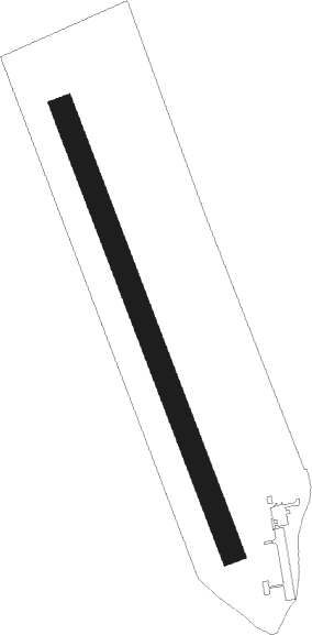
Runway info
| Runway 16 / 34 | ||
| length | 1013m (3323ft) | |
| bearing | 156° / 336° | |
| width | 50m (164ft) | |
| surface | grass | |
Nearby beacons
| code | identifier | dist | bearing | frequency |
|---|---|---|---|---|
| SAG | SAJOHIDVEG VOR/DME | 11.5 | 122° | 114.40 |
| KE | KOSICE NDB | 31.8 | 44° | 425 |
| PQ | NYIREGYHAZA NDB | 37.2 | 99° | 522 |
| KSC | KOSICE VOR/DME | 37.4 | 40° | 108.20 |
| NYR | NYIREGYHAZA VOR/DME | 37.4 | 99° | 116.10 |
| Y | NYIREGYHAZA 36 NDB | 37.7 | 101° | 346 |
| NY | NYIREGYHAZA 36 NDB | 38.6 | 104° | 330 |
| C | DEBRECEN NDB | 51.4 | 130° | 326 |
| EN | DEBRECEN NDB | 51.4 | 124° | 383 |
| DC | DEBRECEN NDB | 51.6 | 131° | 295 |
| DUB | DME | 54.1 | 41° | 108.65 |
| PE | TATRY EAST NDB | 57 | 339° | 438 |
| PPD | TATRY VOR/DME | 58.1 | 335° | 112.10 |
| PPD | TATRY NDB | 58.3 | 335° | 317 |
| OA | SZOLNOK NDB | 62.4 | 208° | 282 |
| PW | TATRY WEST NDB | 63.1 | 323° | 418 |
Disclaimer
The information on this website is not for real aviation. Use this data with the X-Plane flight simulator only! Data taken with kind consent from X-Plane 12 source code and data files. Content is subject to change without notice.