Szentkirályszabadja
Airport details
| Country | Hungary |
| State | Veszprém |
| Region | LH |
| Airspace | Budapest Ctr |
| Elevation | 917ft (280m) |
| Timezone | GMT +1 |
| Coordinates | 47.08206, 17.96791 |
| Magnetic var | |
| Type | land |
| Available since | X-Plane v10.40 |
| ICAO code | LHSA |
| IATA code | n/a |
| FAA code | n/a |
Communication
| Szentkirályszabadja UNICOM | 133.425 |
Nearby Points of Interest:
Balatonkenesei Tátorjános
-Pauline monastery ruin
-Sárvíz-völgye Tájvédelmi Körzet
-Vértesi Tájvédelmi Körzet
-Velencei madárrezervátum
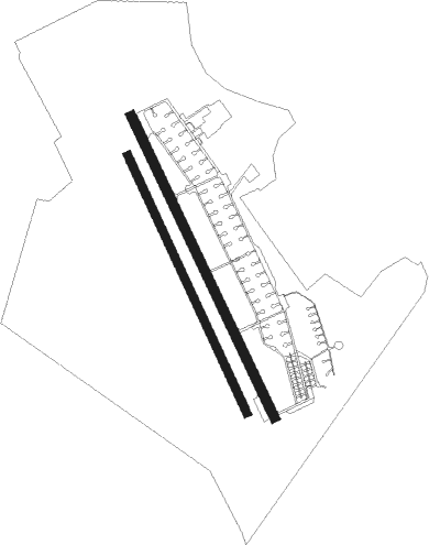
Runway info
Runway 16 / 34  | ||
| length | 2002m (6568ft) | |
| bearing | 151° / 331° | |
| width | 60m (197ft) | |
| surface | asphalt | |
| Runway 16R / 34L | ||
| length | 1702m (5584ft) | |
| bearing | 151° / 331° | |
| width | 50m (164ft) | |
| surface | grass | |
Nearby beacons
| code | identifier | dist | bearing | frequency |
|---|---|---|---|---|
| SVR | SAGVAR VOR/DME | 16.4 | 149° | 117.70 |
| PC | PAPA NDB | 23 | 298° | 318 |
| P | PAPA NDB | 24.4 | 300° | 493 |
| PCT | PAPA VORTAC | 26.4 | 302° | 114.75 |
| C | PAPA NDB | 26.5 | 302° | 493 |
| CP | PAPA NDB | 27.9 | 304° | 318 |
| PTB | PUSZTASZABOLCS VOR/DME | 31.9 | 85° | 117.10 |
| GYR | GYOR VOR/DME | 36 | 337° | 115.10 |
| SME | SARMELLEK NDB | 41.3 | 243° | 436 |
Disclaimer
The information on this website is not for real aviation. Use this data with the X-Plane flight simulator only! Data taken with kind consent from X-Plane 12 source code and data files. Content is subject to change without notice.