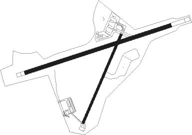
Pantelleria (tp) - Pantelleria
Airport details
| Country | Italy |
| State | Sicily |
| Region | LI |
| Airspace | Rome Ctr |
| Municipality | Pantelleria |
| Elevation | 632ft (193m) |
| Timezone | GMT +1 |
| Coordinates | 36.81348, 11.96906 |
| Magnetic var | |
| Type | land |
| Available since | X-Plane v10.40 |
| ICAO code | LICG |
| IATA code | PNL |
| FAA code | n/a |
Communication
| Pantelleria Pantelleria Tower | 122.100 |
| Pantelleria Pantelleria Tower | 118.450 |
| Pantelleria Pantelleria Approach | 119.350 |
| Pantelleria Pantelleria Departure | 119.350 |
Approach frequencies
| LOC | RW26 | 110.9 | 18.00mi |
Nearby beacons
| code | identifier | dist | bearing | frequency |
|---|---|---|---|---|
| PAN | PANTELLERIA VOR/DME | 0.1 | 286° | 116.10 |
| PAN | PANTELLERIA NDB | 0.4 | 255° | 335 |
| CBN | CAP BON VOR | 42.5 | 275° | 112.70 |
| BN | SIDI BEL ABIOD NDB | 47 | 286° | 313 |
Departure and arrival routes
| Transition altitude | 5000ft |
| SID end points | distance | outbound heading | |
|---|---|---|---|
| RW03 | |||
| ROBE5C | 14mi | 2° | |
| DOBI5C | 20mi | 153° | |
| RW08 | |||
| ROBE5A | 14mi | 2° | |
| RUBR5A | 14mi | 154° | |
| RW21 | |||
| ROBE5D | 14mi | 2° | |
| DOBI5D | 20mi | 153° | |
| RW26 | |||
| ROBE5B | 14mi | 2° | |
| RUBR5B | 14mi | 154° | |
| STAR starting points | distance | inbound heading | |
|---|---|---|---|
| ALL | |||
| ROBE1B, ROBE2R, ROBE1Z, ROBE1T, ROBE1E, ROBE1D, ROBE1C | 14.0 | 182° | |
| RUBR1A, RUBR1C, RUBR1D, RUBR1Z | 13.9 | 334° | |
| RW21 | |||
| EKRU1A | 11.1 | 116° | |
| ROBE1A | 14.0 | 182° | |
| DOBI1A | 20.3 | 333° | |
Instrument approach procedures
| runway | airway (heading) | route (dist, bearing) |
|---|---|---|
| RW08 | KAPPE (80°) | KAPPE 5000ft CG752 (5mi, 163°) 4000ft CG753 (5mi, 259°) 4000ft CG754 (5mi, 343°) 4000ft |
| RNAV | CG754 4000ft KAPPE (5mi, 79°) 4000ft LICG (9mi, 80°) 678ft CG733 (7mi, 78°) 2000ft CG756 (5mi, 343°) 3000ft CG757 (16mi, 259°) 4000ft KAPPE (5mi, 163°) 4000ft KAPPE (turn) 4000ft | |
| RW21 | PAN (106°) | PAN 4000ft CG774 (6mi, 91°) 4000ft CG773 (7mi, 33°) 2500ft CG772 (5mi, 293°) 2500ft |
| RW21 | ROBET (182°) | ROBET 4000ft CG772 (7mi, 138°) 2500ft |
| RNAV | CG772 2500ft CG771 (4mi, 213°) 2500ft LICG (6mi, 212°) 637ft EKRUP (11mi, 296°) 3000ft EKRUP (turn) 3000ft | |
| RW26 | LAMUP (204°) | LAMUP 5000ft CG731 (10mi, 79°) 5000ft CG732 (5mi, 163°) 4000ft |
| RNAV | CG732 4000ft CG733 (7mi, 259°) 3000ft LICG (7mi, 258°) 646ft CG734 (6mi, 260°) CG735 (5mi, 343°) LAMUP (10mi, 79°) 4000ft LAMUP (turn) 4000ft |
Holding patterns
| STAR name | hold at | type | turn | heading* | altitude | leg | speed limit |
|---|---|---|---|---|---|---|---|
| BABI1A | BABIK | VHF | right | 257 (77)° | > 4500ft | DME 4.0mi | ICAO rules |
| DOBI1A | PAN | NDB | right | 95 (275)° | > 4000ft | 1.0min timed | ICAO rules |
| EKRU1A | EKRUP | VHF | right | 300 (120)° | > 4000ft | DME 4.0mi | 210 |
| EKRU1A | PAN | NDB | right | 95 (275)° | > 4000ft | 1.0min timed | ICAO rules |
| ROBE1A | PAN | NDB | right | 95 (275)° | > 4000ft | 1.0min timed | ICAO rules |
| ROBE1B | DEROG | VHF | left | 72 (252)° | > 4000ft | DME 4.0mi | 210 |
| ROBE1C | BABIK | VHF | right | 257 (77)° | > 4500ft | DME 4.0mi | ICAO rules |
| ROBE1E | VAXOT | VHF | left | 75 (255)° | > 4000ft | DME 4.0mi | 210 |
| ROBE1Z | KAPPE | VHF | right | 255 (75)° | 5000ft - 6000ft | DME 3.7mi | 200 |
| ROBE2R | LAMUP | VHF | left | 255 (75)° | > 5000ft | DME 4.2mi | 230 |
| RUBR1C | BABIK | VHF | right | 257 (77)° | > 4500ft | DME 4.0mi | ICAO rules |
| RUBR1Z | KAPPE | VHF | right | 255 (75)° | 5000ft - 6000ft | DME 3.7mi | 200 |
| *) magnetic outbound (inbound) holding course | |||||||
Disclaimer
The information on this website is not for real aviation. Use this data with the X-Plane flight simulator only! Data taken with kind consent from X-Plane 12 source code and data files. Content is subject to change without notice.

