Pavullo (mo) - Pavullo
Airport details
| Country | Italy |
| State | Emilia-Romagna |
| Region | LI |
| Airspace | Milan Ctr |
| Municipality | Pavullo nel Frignano |
| Elevation | 2211ft (674m) |
| Timezone | GMT +1 |
| Coordinates | 44.31888, 10.82908 |
| Magnetic var | |
| Type | land |
| Available since | X-Plane v10.40 |
| ICAO code | LIDP |
| IATA code | n/a |
| FAA code | n/a |
Communication
| PAVULLO Pavullo Radio | 122.600 |
Nearby Points of Interest:
Chiesa della Beata Vergine del Carmine
-Castello di Sestola
-Church of Saint Sylvester
-Rocca di Montefiorino
-Museo della Repubblica partigiana di Montefiorino
-Passo della Croce Arcana
-Chiesa dei Santi Senesio e Teopompo Martiri
-Chiesa dei Santi Nazario e Celso Martiri
-Politeama Sociale
-Abbazia di Santa Maria Assunta
-Castel di Mura
-Terramara's archaeologic park and museum of Montale
-San Prospero Church
-Defensive towers of Popiglio
-Santa Maria Assunta
-San Cesario Church
-Chiesa di San Savino
-Chiesa di Santa Maria Annunziata
-Edifici ex Bini
-Forte Urbano
-Villa Marescalchi
-Palazzo comunale
-Museums of the Modena Cathedral
-Galleria Estense
Runway info
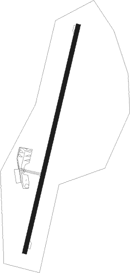
| Runway 02 / 20 | ||
| length | 1188m (3898ft) | |
| bearing | 24° / 204° | |
| width | 23m (75ft) | |
| surface | asphalt | |
| displ threshold | 259m (850ft) / 69m (226ft) | |
Nearby beacons
| code | identifier | dist | bearing | frequency |
|---|---|---|---|---|
| BOA | BOLOGNA VOR/DME | 23.7 | 65° | 117.10 |
| PRT | PERETOLA (FLORENCE) VOR/DME | 34.5 | 144° | 112.50 |
| PIN | PISA TACAN | 39.8 | 214° | 108.30 |
| SAZ | SARZANA TACAN | 41 | 255° | 111.10 |
| PIS | PISA VOR/DME | 42.9 | 214° | 112.10 |
| PIS | PISA NDB | 49.4 | 216° | 379 |
Disclaimer
The information on this website is not for real aviation. Use this data with the X-Plane flight simulator only! Data taken with kind consent from X-Plane 12 source code and data files. Content is subject to change without notice.