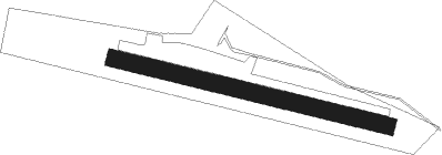
Ferrara (fe) - Prati Vecchi D' Aguscello
Airport details
| Country | Italy |
| State | Emilia-Romagna |
| Region | LI |
| Airspace | Milan Ctr |
| Municipality | Ferrara |
| Elevation | 20ft (6m) |
| Timezone | GMT +1 |
| Coordinates | 44.79028, 11.66917 |
| Magnetic var | |
| Type | land |
| Available since | X-Plane v10.40 |
| ICAO code | LIDV |
| IATA code | n/a |
| FAA code | n/a |
Communication
| PRATI VECCHI D' AGUSCELLO Aguscello Radio | 118.200 |
Nearby Points of Interest:
Ex chiesa di San Pietro
-Palazzo Tassoni Estense
-Palazzo Giglioli
-Casa Minerbi - Del Sale (Ferrara)
-Chiesa e chiostro dell'ex Monastero di Santa Maria delle Grazie
-Teatro Giuseppe Verdi
-Ariostea Town Library
-Ex chiesa ed ex convento di Santa Margherita
-Ferrara
-Sala Estense
-Chiesa di San Giuliano
-Piazza Ariostea (Ferrara)
-Palazzo Balbo
-Museo Michelangelo Antonioni
-Palazzo Trotti Mosti
-Museo Civico di Belriguardo
-Torrione del Barco
-Documentation Centre of the agricultural world Ferrara
-Santa Maria di Savonuzzo (Copparo)
-Palazzo Sessa Aldrovandi
-Teatro De Micheli
-Torre di Santo Stefano
-Casone del partigiano
-Chiesa di San Giovanni
-Chiesa di Santa Maria del Carmine
Runway info
| Runway 10 / 28 | ||
| length | 800m (2625ft) | |
| bearing | 103° / 283° | |
| width | 50m (164ft) | |
| surface | grass | |
Nearby beacons
| code | identifier | dist | bearing | frequency |
|---|---|---|---|---|
| BOA | BOLOGNA VOR/DME | 22.1 | 236° | 117.10 |
| CHI | CHIOGGIA NDB | 31 | 65° | 408 |
| IPD | DME-ILS | 36.9 | 16° | 111.30 |
| FOL | FORLI VOR/DME | 39.6 | 146° | 115.75 |
| CEV | CERVIA TACAN | 45.8 | 130° | 113.60 |
| VIL | VILLAFRANCA VORTAC | 49.2 | 309° | 115.80 |
| VIC | VICENZA NDB | 50.8 | 0° | 417 |
| TES | TESSERA VOR/DME | 52.8 | 44° | 115.30 |
| TRE | TREVISO NDB | 53.1 | 27° | 301 |
| RIM | RIMINI NDB | 55.7 | 130° | 335 |
| TEV | DME-ILS | 55.8 | 31° | 108.55 |
| ISA | ISTRANA TACAN | 57.1 | 27° | 111.70 |
| RIM | RIMINI VORTAC | 61.8 | 129° | 116.20 |
| RMN | (RIMINI) DME | 61.8 | 129° | 108.80 |
| PRT | PERETOLA (FLORENCE) VOR/DME | 62.2 | 206° | 112.50 |
Disclaimer
The information on this website is not for real aviation. Use this data with the X-Plane flight simulator only! Data taken with kind consent from X-Plane 12 source code and data files. Content is subject to change without notice.
