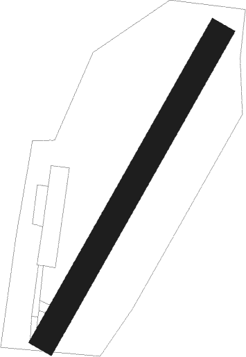
Alessandria
Airport details
| Country | Italy |
| State | Piedmont |
| Region | LI |
| Airspace | Milan Ctr |
| Municipality | Alessandria |
| Elevation | 296ft (90m) |
| Timezone | GMT +1 |
| Coordinates | 44.92500, 8.62528 |
| Magnetic var | |
| Type | land |
| Available since | X-Plane v10.30 |
| ICAO code | LILA |
| IATA code | n/a |
| FAA code | n/a |
Communication
Nearby Points of Interest:
Cittadella of Alessandria
-Bassignana
-Pieve del Cairo
-Tortona
-Mede
-Villa Biscossi
-Breme
-chiesa parrocchiale di San Giovanni Battista
-San Vincenzo
-Nizza Monferrato
-Silvano Pietra
-Ferrera Erbognone
-Candia Lomellina
-Sannazzaro de' Burgondi
-Ottobiano
-Voghera
-Scaldasole
-Valeggio
-Voghera FVV train station
-Tempio Sacrario della Cavalleria
-Retorbido
-Cergnago
-San Giorgio di Lomellina
-Sacro Monte di Crea
-Alagna
Runway info
| Runway 03 / 21 | ||
| length | 803m (2635ft) | |
| bearing | 44° / 224° | |
| width | 60m (197ft) | |
| surface | grass | |
| displ threshold | 73m (240ft) / 65m (213ft) | |
Nearby beacons
| code | identifier | dist | bearing | frequency |
|---|---|---|---|---|
| VOG | VOGHERA VOR/DME | 14.8 | 83° | 110.45 |
| VOG | VOGHERA NDB | 14.9 | 84° | 333 |
| NOV | NOVARA (MILAN) NDB | 30.8 | 19° | 292 |
| SES | SESTRI (GENOA) VOR/DME | 31.6 | 159° | 108.60 |
| TOP | TORINO VOR/DME | 32.4 | 270° | 114.50 |
| TOP | TORINO NDB | 32.5 | 270° | 392 |
| GEN | GENOA NDB | 35.8 | 138° | 318 |
| MAL | MALPENSA (MILAN) NDB | 37.6 | 12° | 364 |
| LNE | LINATE (MILAN) NDB | 37.7 | 58° | 386 |
| CAM | CAMERI TACAN | 38.7 | 3° | 115 |
| LIN | LINATE (MILAN) VOR/DME | 42.3 | 50° | 112.25 |
| COD | CODOGNO NDB | 42.8 | 72° | 400 |
| MMP | MALPENSA (MILAN) NDB | 43.1 | 9° | 425 |
| MMP | MALPENSA (MILAN) VOR/DME | 43.2 | 9° | 113.35 |
| CAS | CASELLE TACAN | 44.2 | 285° | 109.50 |
| CSL | CASELLE VOR/DME | 45 | 287° | 116.75 |
| SRN | SARONNO NDB | 46.4 | 29° | 330 |
| TZO | TREZZO NDB | 53.3 | 54° | 345 |
| ABN | ALBENGA NDB | 54.9 | 205° | 420 |
| ALB | ALBENGA VOR/DME | 56.8 | 210° | 116.95 |
| SVC | COMAGNE (AOSTA) NDB | 62.4 | 312° | 418 |
Disclaimer
The information on this website is not for real aviation. Use this data with the X-Plane flight simulator only! Data taken with kind consent from X-Plane 12 source code and data files. Content is subject to change without notice.
