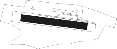
Varese (va) - Calcinate Del Pesce
Airport details
| Country | Italy |
| State | Lombardy |
| Region | LI |
| Airspace | Milan Ctr |
| Municipality | Varese |
| Elevation | 794ft (242m) |
| Timezone | GMT +1 |
| Coordinates | 45.80972, 8.76806 |
| Magnetic var | |
| Type | land |
| Available since | X-Plane v10.40 |
| ICAO code | LILC |
| IATA code | n/a |
| FAA code | n/a |
Communication
| Calcinate del Pesce ACAO Radio | 128.455 |
Nearby Points of Interest:
Cazzago Brabbia
-Galliate Lombardo
-Biandronno
-Villa Mirabello
-Varese
-Gavirate
-Induno Olona
-Morazzone
-Lozza
-Varano Borghi
-Brinzio
-Cantello
-Malnate
-Besozzo
-Orino
-Brebbia
-Arcisate
-Bisuschio
-Rancio Valcuvia
-Cuvio
-Castiglione Olona
-Gornate Olona
-Gemonio
-Albizzate
-Cuveglio
Nearby beacons
| code | identifier | dist | bearing | frequency |
|---|---|---|---|---|
| MMP | MALPENSA (MILAN) VOR/DME | 10.2 | 191° | 113.35 |
| MMP | MALPENSA (MILAN) NDB | 10.3 | 191° | 425 |
| SRN | SARONNO NDB | 14.4 | 123° | 330 |
| CAM | CAMERI TACAN | 15.1 | 205° | 115 |
| MAL | MALPENSA (MILAN) NDB | 15.8 | 183° | 364 |
| NOV | NOVARA (MILAN) NDB | 23.1 | 176° | 292 |
| LIN | LINATE (MILAN) VOR/DME | 29.8 | 124° | 112.25 |
| TZO | TREZZO VOR/DME | 34.4 | 109° | 117.25 |
| TZO | TREZZO NDB | 34.5 | 109° | 345 |
| LNE | LINATE (MILAN) NDB | 35.4 | 132° | 386 |
| BEG | BERGAMO VOR/DME | 40.3 | 98° | 114.95 |
| COD | CODOGNO NDB | 47.8 | 127° | 400 |
| VOG | VOGHERA VOR/DME | 51.4 | 167° | 110.45 |
| VOG | VOGHERA NDB | 51.5 | 166° | 333 |
| TOP | TORINO VOR/DME | 65.4 | 226° | 114.50 |
| TOP | TORINO NDB | 65.5 | 226° | 392 |
| PIA | PIACENZA TACAN | 66.9 | 133° | 117.40 |
Disclaimer
The information on this website is not for real aviation. Use this data with the X-Plane flight simulator only! Data taken with kind consent from X-Plane 12 source code and data files. Content is subject to change without notice.