Vercelli
Airport details
| Country | Italy |
| State | Piedmont |
| Region | LI |
| Airspace | Milan Ctr |
| Municipality | Vercelli |
| Elevation | 416ft (127m) |
| Timezone | GMT +1 |
| Coordinates | 45.31111, 8.41750 |
| Magnetic var | |
| Type | land |
| Available since | X-Plane v10.40 |
| ICAO code | LILI |
| IATA code | n/a |
| FAA code | n/a |
Communication
| Vercelli Vercelli Radio Tower | 118.850 |
Nearby Points of Interest:
Palazzo Arcivescovile di Vercelli
-Candia Lomellina
-museo di Storia Naturale
-Albonese
-Castello d'Agogna
-Breme
-Cilavegna
-Sacro Monte di Crea
-Mortara
-Gravellona Lomellina
-San Giorgio di Lomellina
-Cergnago
-Baraggia di Bellinzago
-Lago di Viverone
-San Vincenzo
-San Martino Church
-Mede
-Dogana austriaca
-Ponte antico sul Naviglio Grande
-Turbigo
-Vigevano
-Gambolò
-Palazzo Bellini
-Nosate
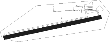
Runway info
| Runway 09 / 27 | ||
| length | 794m (2605ft) | |
| bearing | 85° / 265° | |
| width | 32m (105ft) | |
| surface | grass | |
Nearby beacons
| code | identifier | dist | bearing | frequency |
|---|---|---|---|---|
| NOV | NOVARA (MILAN) NDB | 17.2 | 73° | 292 |
| CAM | CAMERI TACAN | 18.5 | 43° | 115 |
| MAL | MALPENSA (MILAN) NDB | 20 | 55° | 364 |
| MMP | MALPENSA (MILAN) NDB | 23.8 | 44° | 425 |
| VOG | VOGHERA VOR/DME | 31.3 | 122° | 110.45 |
| VOG | VOGHERA NDB | 31.4 | 122° | 333 |
| SRN | SARONNO VOR/DME | 32.4 | 61° | 113.70 |
| SRN | SARONNO NDB | 32.5 | 61° | 330 |
| CSL | CASELLE VOR/DME | 32.9 | 263° | 116.75 |
| CAS | CASELLE TACAN | 33 | 261° | 109.50 |
| TOP | TORINO VOR/DME | 33 | 235° | 114.50 |
| TOP | TORINO NDB | 33.1 | 235° | 392 |
| LNE | LINATE (MILAN) NDB | 36.8 | 88° | 386 |
| LIN | LINATE (MILAN) VOR/DME | 37.2 | 80° | 112.25 |
| SVC | COMAGNE (AOSTA) NDB | 39.4 | 302° | 418 |
| SES | SESTRI (GENOA) VOR/DME | 56.3 | 156° | 108.60 |
| LEV | CUNEO NDB | 57.3 | 226° | 371 |
| GEN | GENOA NDB | 60.3 | 143° | 318 |
Disclaimer
The information on this website is not for real aviation. Use this data with the X-Plane flight simulator only! Data taken with kind consent from X-Plane 12 source code and data files. Content is subject to change without notice.