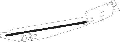
Caiolo - Sondrio Caiolo
Airport details
| Country | Italy |
| State | Lombardy |
| Region | LI |
| Airspace | Milan Ctr |
| Municipality | Caiolo |
| Elevation | 898ft (274m) |
| Timezone | GMT +1 |
| Coordinates | 46.15000, 9.80000 |
| Magnetic var | |
| Type | land |
| Available since | X-Plane v10.40 |
| ICAO code | LILO |
| IATA code | n/a |
| FAA code | n/a |
Communication
| Sondrio Caiolo MILANO INFORMATION | 124.925 |
Nearby Points of Interest:
Berbenno di Valtellina
-chiesa di Santa Maria Assunta
-Colorina
-Sondrio
-Santi Gervasio e Protasio
-Montagna in Valtellina
-Poggiridenti
-Tresivio
-Valleve
-Caspoggio
-Chiuro
-Castello dell'Acqua
-Morbegno
-Gerola Alta
-Valbondione
-Teglio
-Sant'Eufemia
-Traona
-Valgoglio
-Castello Ginami-Buccelleni
-Palazzo Milesi
-Roncobello
-Olmo al Brembo
-Cercino
-Santa Brigida
Nearby beacons
| code | identifier | dist | bearing | frequency |
|---|---|---|---|---|
| CVA | DME | 16.1 | 5° | 112.05 |
| BEG | BERGAMO VOR/DME | 29.1 | 191° | 114.95 |
| ORI | ORIO AL SERIO (BERGAMO) NDB | 30.4 | 175° | 376 |
| TZO | TREZZO NDB | 37.5 | 206° | 345 |
| WFJ | DME | 41.1 | 360° | 113.75 |
| SRN | SARONNO NDB | 44.3 | 237° | 330 |
| SRN | SARONNO VOR/DME | 44.4 | 237° | 113.70 |
| GHE | GHEDI TACAN | 46.8 | 147° | 110.90 |
| LIN | LINATE (MILAN) VOR/DME | 46.8 | 217° | 112.25 |
| BSA | BRESCIA VOR/DME | 47.9 | 144° | 117.70 |
| LNE | LINATE (MILAN) NDB | 52.9 | 212° | 386 |
| COD | CODOGNO NDB | 56.5 | 196° | 400 |
Disclaimer
The information on this website is not for real aviation. Use this data with the X-Plane flight simulator only! Data taken with kind consent from X-Plane 12 source code and data files. Content is subject to change without notice.