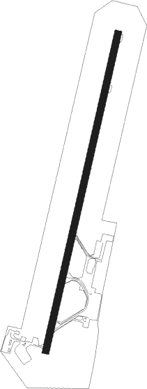
Parma
Airport details
| Country | Italy |
| State | Emilia-Romagna |
| Region | LI |
| Airspace | Milan Ctr |
| Municipality | Parma |
| Elevation | 161ft (49m) |
| Timezone | GMT +1 |
| Coordinates | 44.81880, 10.29085 |
| Magnetic var | |
| Type | land |
| Available since | X-Plane v10.40 |
| ICAO code | LIMP |
| IATA code | PMF |
| FAA code | n/a |
Communication
| Parma Parma Tower | 118.450 |
| Parma Parma Approach | 127.575 |
Approach frequencies
| ILS-cat-I | RW20 | 110.5 | 18.00mi |
| 3° GS | RW20 | 110.5 | 18.00mi |
Nearby Points of Interest:
Villa Levi-Tedeschi
-Biblioteca Palatina di Parma
-Palazzo della Pilotta
-Palazzo dell'Intendenza di Finanza
-Palazzo di Riserva
-Romagnosi
-Palazzo delle Orsoline
-Palazzo del Tribunale
-Palazzo Soragna
-Palazzo Vescovile
-Palazzo Bossi Bocchi
-Palazzo della Fondazione Monteparma
-Palazzo Tirelli
-Palazzo Tarasconi
-Palazzo Cusani, Parma
-Palazzo Carmi
-Palazzo Sanvitale
-Sinagoga di Parma
-Palazzo Pallavicino
-Palazzo Dazzi
-Palazzo Rangoni Farnese
-Palazzo Boselli
-Palazzo Marchi
-San Sepolcro
-Palazzo Giordani
Nearby beacons
| code | identifier | dist | bearing | frequency |
|---|---|---|---|---|
| PIA | PIACENZA TACAN | 24.9 | 280° | 117.40 |
| BSA | BRESCIA VOR/DME | 37.2 | 2° | 117.70 |
| GHE | GHEDI TACAN | 37.3 | 358° | 110.90 |
| COD | CODOGNO NDB | 40.1 | 299° | 400 |
| VIL | VILLAFRANCA VORTAC | 43.9 | 46° | 115.80 |
| BOA | BOLOGNA VOR/DME | 45.9 | 106° | 117.10 |
| SAZ | SARZANA TACAN | 47.1 | 205° | 111.10 |
| ORI | ORIO AL SERIO (BERGAMO) NDB | 53 | 331° | 376 |
| TZO | TREZZO NDB | 55.3 | 313° | 345 |
| TZO | TREZZO VOR/DME | 55.4 | 313° | 117.25 |
| BEG | BERGAMO VOR/DME | 56.7 | 326° | 114.95 |
Departure and arrival routes
| Transition altitude | 6000ft |
| SID end points | distance | outbound heading | |
|---|---|---|---|
| RW02 | |||
| BETM6Z | 24mi | 105° | |
| LUPO6Z | 23mi | 137° | |
| MISP6Z | 15mi | 314° | |
| RW20 | |||
| BETM6W | 24mi | 105° | |
| LUPO6W | 23mi | 137° | |
| MISP6T, MISP6W | 15mi | 314° | |
| STAR starting points | distance | inbound heading | |
|---|---|---|---|
| RW20 | |||
| MISP2A | 15.2 | 134° | |
| BETM2D | 24.3 | 285° | |
| LUPO2A | 22.5 | 317° | |
Instrument approach procedures
| runway | airway (heading) | route (dist, bearing) |
|---|---|---|
| RW20 | IXUKI (181°) | IXUKI 3000ft MP702 (3mi, 102°) 2500ft |
| RW20 | OGSOK (135°) | OGSOK 6000ft IXUKI (7mi, 86°) 3000ft MP702 (3mi, 102°) 2500ft |
| RW20 | OSBUL (216°) | OSBUL 6000ft MP406 (7mi, 314°) 3000ft MP411 (4mi, 20°) 3000ft IXUKI (3mi, 86°) 3000ft MP702 (3mi, 102°) 2500ft |
| RNAV | MP702 2500ft MP703 (4mi, 204°) 1800ft LIMP (6mi, 205°) 197ft MP704 (2mi, 200°) 900ft MP706 (3mi, 164°) 1400ft MP707 (5mi, 52°) OSBUL (4mi, 290°) 3000ft OGSOK (11mi, 314°) 6000ft OGSOK (turn) 6000ft |
Holding patterns
| STAR name | hold at | type | turn | heading* | altitude | leg | speed limit |
|---|---|---|---|---|---|---|---|
| BETM2D | OSBUL | VHF | left | 214 (34)° | > 6000ft | DME 4.0mi | 200 |
| LUPO2A | OSBUL | VHF | left | 214 (34)° | > 6000ft | DME 4.0mi | 200 |
| MISP2A | OGSOK | VHF | right | 229 (49)° | > 6000ft | DME 3.0mi | 185 |
| *) magnetic outbound (inbound) holding course | |||||||
Disclaimer
The information on this website is not for real aviation. Use this data with the X-Plane flight simulator only! Data taken with kind consent from X-Plane 12 source code and data files. Content is subject to change without notice.
