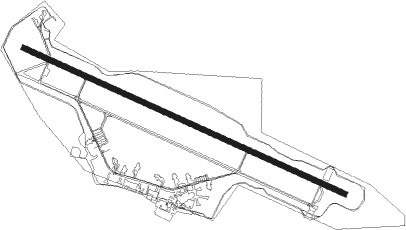
Piacenza - Piacenza San Damiano
Airport details
| Country | Italy |
| State | Emilia-Romagna |
| Region | LI |
| Airspace | Milan Ctr |
| Municipality | San Giorgio Piacentino |
| Elevation | 456ft (139m) |
| Timezone | GMT +1 |
| Coordinates | 44.91386, 9.72059 |
| Magnetic var | |
| Type | land |
| Available since | X-Plane v10.40 |
| ICAO code | LIMS |
| IATA code | QPZ |
| FAA code | n/a |
Communication
| PIACENZA San Damiano Tower | 136.075 |
| PIACENZA San Damiano Tower | 122.100 |
| PIACENZA San Damiano Approach | 123.925 |
Nearby Points of Interest:
San Germano Church
-Castello di San Polo
-Chiesa di San Giacomo Maggiore
-Castello di Zena
-chiesa di Sant'Agata
-Montechino Castle
-Castello di Pigazzano
-Collegiata di Castell'Arquato
-Castello di Gazzola
-Parco Archeologico Villaggio Neolitico
-Giuseppe Verdi Theatre
-Castello di Lisignano
-Castello Anguissola
-Archivio di Stato di Piacenza
-Torre di Montebolzone
-Teatro Eleonora Duse
-Rocca Mandelli
-Chiesa di Santa Maria Assunta
-Castelnuovo Fogliani Castle
-Museo della Resistenza piacentina
-Corno Giovine
-Castelnuovo Bocca d’Adda
-Fombio
-Castello di Seminò
-Palazzo del monte
Nearby beacons
| code | identifier | dist | bearing | frequency |
|---|---|---|---|---|
| PIA | PIACENZA TACAN | 0.2 | 4° | 117.40 |
| COD | CODOGNO NDB | 20.2 | 330° | 400 |
| LNE | LINATE (MILAN) NDB | 31.6 | 315° | 386 |
| VOG | VOGHERA NDB | 31.9 | 274° | 333 |
| VOG | VOGHERA VOR/DME | 32 | 274° | 110.45 |
| LIN | LINATE (MILAN) VOR/DME | 37.8 | 321° | 112.25 |
| GHE | GHEDI TACAN | 39.1 | 46° | 110.90 |
| TZO | TREZZO NDB | 39.7 | 342° | 345 |
| GEN | GENOA NDB | 40 | 232° | 318 |
| BSA | BRESCIA VOR/DME | 40.3 | 49° | 117.70 |
| ORI | ORIO AL SERIO (BERGAMO) NDB | 44.1 | 9° | 376 |
| BEG | BERGAMO VOR/DME | 45.3 | 359° | 114.95 |
| SES | SESTRI (GENOA) VOR/DME | 48.5 | 241° | 108.60 |
| NOV | NOVARA (MILAN) NDB | 49.7 | 299° | 292 |
| SAZ | SARZANA TACAN | 51.2 | 165° | 111.10 |
| SRN | SARONNO NDB | 52.9 | 316° | 330 |
| MAL | MALPENSA (MILAN) NDB | 55.7 | 303° | 364 |
| MMP | MALPENSA (MILAN) NDB | 60.2 | 306° | 425 |
| MMP | MALPENSA (MILAN) VOR/DME | 60.3 | 306° | 113.35 |
Departure and arrival routes
| Transition altitude | 6000ft |
| SID end points | distance | outbound heading | |
|---|---|---|---|
| RW12 | |||
| CORT5H, CORT5V | 47mi | 86° | |
| LUPO5U | 44mi | 115° | |
| KALM6V | 36mi | 192° | |
| VOG5V | 32mi | 274° | |
| RW30 | |||
| CORT5G, CORT5Q | 47mi | 86° | |
| LUPO5T | 44mi | 115° | |
| KALM6Q | 36mi | 192° | |
| VOG5Q | 32mi | 274° | |
| STAR starting points | distance | inbound heading | |
|---|---|---|---|
| ALL | |||
| VOG2Q | 31.9 | 94° | |
| CORT1Q | 46.9 | 266° | |
| LUPO1Q | 44.1 | 295° | |
| RW12 | |||
| VOG1V | 31.9 | 94° | |
Holding patterns
| STAR name | hold at | type | turn | heading* | altitude | leg | speed limit |
|---|---|---|---|---|---|---|---|
| CORT1Q | CEDRO | VHF | right | 121 (301)° | > 5000ft | DME 6.0mi | ICAO rules |
| GEN1Q | CEDRO | VHF | right | 121 (301)° | > 5000ft | DME 6.0mi | ICAO rules |
| GEN1V | BASCO | VHF | right | 175 (355)° | > 10000ft | 1.0min timed | ICAO rules |
| LUPO1Q | CEDRO | VHF | right | 121 (301)° | > 5000ft | DME 6.0mi | ICAO rules |
| VOG1V | BASCO | VHF | right | 175 (355)° | > 10000ft | 1.0min timed | ICAO rules |
| VOG2Q | CEDRO | VHF | right | 121 (301)° | > 5000ft | DME 6.0mi | ICAO rules |
| *) magnetic outbound (inbound) holding course | |||||||
Disclaimer
The information on this website is not for real aviation. Use this data with the X-Plane flight simulator only! Data taken with kind consent from X-Plane 12 source code and data files. Content is subject to change without notice.
