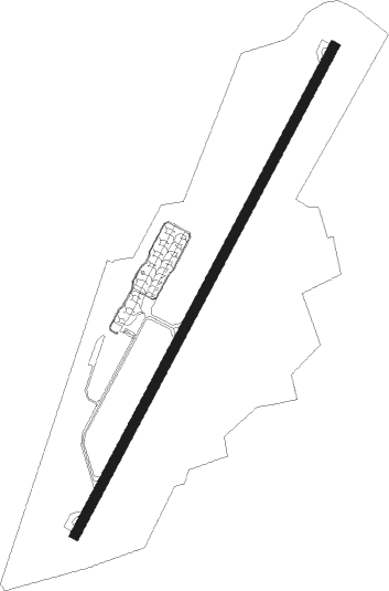
Cuneo - Levaldigi
Airport details
| Country | Italy |
| State | Piedmont |
| Region | LI |
| Airspace | Milan Ctr |
| Municipality | Fossano |
| Elevation | 1267ft (386m) |
| Timezone | GMT +1 |
| Coordinates | 44.54750, 7.62306 |
| Magnetic var | |
| Type | land |
| Available since | X-Plane v10.40 |
| ICAO code | LIMZ |
| IATA code | CUF |
| FAA code | n/a |
Communication
| Levaldigi CUNEO INFO | 119.550 |
Approach frequencies
| ILS-cat-I | RW21 | 110.95 | 18.00mi |
| 3° GS | RW21 | 110.95 | 18.00mi |
Nearby Points of Interest:
San Pietro
-WI. MU. Museo del Vino
-Frassino
-Langhe
-Montferrat
-The Vineyard Landscape of Piedmont: Langhe-Roero and Monferrato
-Sant'Agostino
-Chiesa di San FIlippo
-Barbaresco
-San Giovanni Battista
-Chiesa di Sant'Andrea
-Bosco di Pian Prà
-Villa Cavour
-Monte Antoroto
-Monte Viso Tunnel
-Pra - Barant
-Monte Spinarda - Rio Nero
-Alte Valli Stura e Maira
-Lago di Osiglia
Nearby beacons
| code | identifier | dist | bearing | frequency |
|---|---|---|---|---|
| LEV | CUNEO NDB | 0.3 | 247° | 371 |
| TOP | TORINO NDB | 24.8 | 32° | 392 |
| ALB | ALBENGA VOR/DME | 37 | 135° | 116.95 |
| CAS | CASELLE TACAN | 38.8 | 3° | 109.50 |
| ABN | ALBENGA NDB | 39.1 | 129° | 420 |
| CSL | CASELLE VOR/DME | 40.3 | 2° | 116.75 |
| NIZ | NICE COTE D'AZUR VOR/DME | 49.2 | 205° | 112.40 |
| AZR | NICE VOR/DME | 56 | 204° | 109.65 |
| CGS | CAGNES-SUR-MER VOR/DME | 57.9 | 208° | 109.20 |
| NC | NICE NDB | 61.3 | 207° | 338 |
| CNM | CANNES VOR | 67.5 | 217° | 111.40 |
Departure and arrival routes
| Transition altitude | 6000ft |
| SID end points | distance | outbound heading | |
|---|---|---|---|
| RW03 | |||
| CANE8Q | 111mi | 38° | |
| ABES8Q | 114mi | 41° | |
| SRN8Q | 89mi | 52° | |
| LAGE8Q, LAGE6P | 39mi | 100° | |
| ENOB8Q, ENOB6P | 33mi | 110° | |
| IXUS8Q | 40mi | 328° | |
| KUKE7Q | 69mi | 339° | |
| RW21 | |||
| CANE8Q | 111mi | 38° | |
| ABES8Q | 114mi | 41° | |
| SRN8Q | 89mi | 52° | |
| LAGE6P, LAGE8Q | 39mi | 100° | |
| ENOB8Q, ENOB6P | 33mi | 110° | |
| IXUS8Q | 40mi | 328° | |
| KUKE7Q | 69mi | 339° | |
| STAR starting points | distance | inbound heading | |
|---|---|---|---|
| ALL | |||
| LAGE2D | 38.6 | 280° | |
| ENOB2B | 32.8 | 290° | |
| ABN1T | 39.1 | 309° | |
Instrument approach procedures
| runway | airway (heading) | route (dist, bearing) |
|---|---|---|
| RW21 | TOPRU (222°) | TOPRU 4000ft MZ701 (3mi, 222°) 3500ft |
| RW21 | TUGBA (234°) | TUGBA 4000ft TOPRU (4mi, 264°) 4000ft MZ701 (3mi, 222°) 3500ft |
| RNAV | MZ701 3500ft LIMZ (8mi, 222°) 1267ft MZ702 (2mi, 222°) 1800ft MZ706 (10mi, 76°) 4000ft TUGBA (7mi, 6°) 4000ft TUGBA (turn) 4000ft |
Holding patterns
| STAR name | hold at | type | turn | heading* | altitude | leg | speed limit |
|---|---|---|---|---|---|---|---|
| ABN1T | TOPRU | VHF | right | 16 (196)° | > 4000ft | DME 4.0mi | ICAO rules |
| ENOB2B | LEV | FIX | left | 23 (203)° | 5000ft - 6000ft | 1.0min timed | 210 |
| LAGE2D | TOPRU | VHF | right | 16 (196)° | > 4000ft | DME 4.0mi | ICAO rules |
| TOP2D | TOP | NDB | right | 99 (279)° | > 4000ft | 1.0min timed | ICAO rules |
| TOP2D | TOPRU | VHF | right | 16 (196)° | > 4000ft | DME 4.0mi | ICAO rules |
| TOP4B | LEV | FIX | left | 23 (203)° | 5000ft - 6000ft | 1.0min timed | 210 |
| TOP4B | TOP | NDB | right | 99 (279)° | > 4000ft | 1.0min timed | ICAO rules |
| *) magnetic outbound (inbound) holding course | |||||||
Disclaimer
The information on this website is not for real aviation. Use this data with the X-Plane flight simulator only! Data taken with kind consent from X-Plane 12 source code and data files. Content is subject to change without notice.
