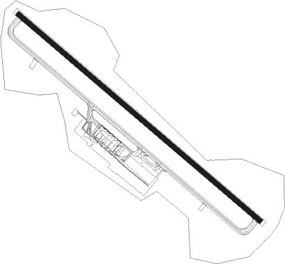
Brescia - Montichiari
Airport details
| Country | Italy |
| State | Lombardy |
| Region | LI |
| Airspace | Milan Ctr |
| Municipality | Montichiari |
| Elevation | 344ft (105m) |
| Timezone | GMT +1 |
| Coordinates | 45.42889, 10.33056 |
| Magnetic var | |
| Type | land |
| Available since | X-Plane v10.40 |
| ICAO code | LIPO |
| IATA code | VBS |
| FAA code | n/a |
Communication
| Montichiari Tower | 119.400 |
| Montichiari Tower | 122.100 |
| Montichiari GARDA Approach | 124.250 |
| Montichiari GARDA Approach | 118.550 |
| Montichiari GARDA Approach | 124.450 |
Approach frequencies
| ILS-cat-III | RW32 | 110.55 | 18.00mi |
| 3° GS | RW32 | 110.55 | 18.00mi |
Nearby Points of Interest:
Ghedi
-Montichiari
-Castenedolo
-Calcinato
-San Michele
-Palazzo Fisogni
-Rezzato
-Mazzano
-Palazzo Modonesi
-Carpenedolo
-Leno
-Bagnolo Mella
-Bedizzole
-Nuvolera
-Poncarale
-Museo storico aloisiano (Castiglione delle Stiviere, Italy)
-Castiglione delle Stiviere
-Palazzo Martinengo da Barco
-Palazzo Martinengo Colleoni di Malpaga (Brescia)
-Calvagese della Riviera
-Church of Santa Maria in Solario
-Coro delle monache
-Church of Santa Giulia
-Brixia
-Querini Library
Nearby beacons
| code | identifier | dist | bearing | frequency |
|---|---|---|---|---|
| BSA | BRESCIA VOR/DME | 0.8 | 302° | 117.70 |
| GHE | GHEDI TACAN | 2.8 | 280° | 110.90 |
| ORI | ORIO AL SERIO (BERGAMO) NDB | 24.2 | 294° | 376 |
| VIL | VILLAFRANCA VORTAC | 24.3 | 92° | 115.80 |
| BEG | BERGAMO VOR/DME | 29.8 | 291° | 114.95 |
| COD | CODOGNO NDB | 35.4 | 256° | 400 |
| TZO | TREZZO NDB | 35.4 | 279° | 345 |
| TZO | TREZZO VOR/DME | 35.5 | 279° | 117.25 |
| PIA | PIACENZA TACAN | 40.1 | 230° | 117.40 |
| TNT | TRENTO VOR/DME | 49.1 | 54° | 115.35 |
| CVA | DME | 63 | 333° | 112.05 |
| BOA | BOLOGNA VOR/DME | 67.3 | 133° | 117.10 |
| OZE | BOLZANO VOR/DME | 71 | 45° | 117.05 |
Departure and arrival routes
| Transition altitude | 6000ft |
| SID end points | distance | outbound heading | |
|---|---|---|---|
| RW14 | |||
| CIBF5C | 27mi | 82° | |
| EXFI5C | 26mi | 85° | |
| EZRA5A | 40mi | 103° | |
| TAGH5A | 45mi | 116° | |
| FAMX5A | 49mi | 132° | |
| LICF5C | 49mi | 133° | |
| OSBU5H | 36mi | 184° | |
| COD5L, COD5H | 35mi | 256° | |
| OSKO5L, OSKO5H | 16mi | 316° | |
| RW32 | |||
| CIBF5B, CIBF5A | 27mi | 82° | |
| EXFI5B, EXFI5A | 26mi | 85° | |
| ADXE5A | 40mi | 102° | |
| UGHA5A | 40mi | 104° | |
| PIQU5A | 44mi | 114° | |
| ETHE5A | 45mi | 117° | |
| AFNE5A | 49mi | 131° | |
| LICF5B, LICF5A | 49mi | 133° | |
| AVCU5A | 48mi | 134° | |
| OSBU5B, OSBU5V | 36mi | 184° | |
| COD5X, COD5W, COD5V, COD5U | 35mi | 256° | |
| OSKO6W, OSKO5X, OSKO5V, OSKO5U | 16mi | 316° | |
| STAR starting points | distance | inbound heading | |
|---|---|---|---|
| ALL | |||
| OSBU1D | 36.4 | 4° | |
| SRN3E | 56.5 | 99° | |
| NEVN3E | 13.7 | 203° | |
| EPCU1A | 23.2 | 256° | |
| OSTE1F | 37.3 | 287° | |
| RICI1A | 49.1 | 306° | |
| RW32 | |||
| OSBU1A | 36.4 | 4° | |
| TZO1T | 35.4 | 99° | |
| NEVN1T, NEVN1W | 13.7 | 203° | |
| TAFI1B, TAFI1A | 18.5 | 251° | |
| PIRW1A | 24.3 | 256° | |
| OSTE1T | 37.3 | 287° | |
Holding patterns
| STAR name | hold at | type | turn | heading* | altitude | leg | speed limit |
|---|---|---|---|---|---|---|---|
| EPCU1A | PILUD | VHF | left | 134 (314)° | > 4000ft | DME 3.5mi | 200 |
| NEVN1T | ADSAS | VHF | right | 309 (129)° | > 5000ft | DME 4.0mi | 210 |
| NEVN1W | UPGAV | VHF | left | 314 (134)° | > 5000ft | DME 4.0mi | 210 |
| NEVN3E | PILUD | VHF | left | 134 (314)° | > 4000ft | DME 3.5mi | 200 |
| OSBU1A | ADSAS | VHF | right | 309 (129)° | > 5000ft | DME 4.0mi | 210 |
| OSBU1D | PILUD | VHF | left | 134 (314)° | > 4000ft | DME 3.5mi | 200 |
| OSTE1F | PILUD | VHF | left | 134 (314)° | > 4000ft | DME 3.5mi | 200 |
| OSTE1T | ELDIP | VHF | left | 133 (313)° | 5000ft - 5000ft | DME 4.0mi | 210 |
| PIRW1A | ELDIP | VHF | left | 133 (313)° | 5000ft - 5000ft | DME 4.0mi | 210 |
| RICI1A | PILUD | VHF | left | 134 (314)° | > 4000ft | DME 3.5mi | 200 |
| SRN3E | PILUD | VHF | left | 134 (314)° | > 4000ft | DME 3.5mi | 200 |
| TAFI1A | UPGAV | VHF | left | 314 (134)° | > 5000ft | DME 4.0mi | 210 |
| TAFI1B | ADSAS | VHF | right | 309 (129)° | > 5000ft | DME 4.0mi | 210 |
| TZO1T | ADSAS | VHF | right | 309 (129)° | > 5000ft | DME 4.0mi | 210 |
| TZO3E | PILUD | VHF | left | 134 (314)° | > 4000ft | DME 3.5mi | 200 |
| XUBK1B | ELDIP | VHF | left | 133 (313)° | 5000ft - 5000ft | DME 4.0mi | 210 |
| *) magnetic outbound (inbound) holding course | |||||||
Disclaimer
The information on this website is not for real aviation. Use this data with the X-Plane flight simulator only! Data taken with kind consent from X-Plane 12 source code and data files. Content is subject to change without notice.