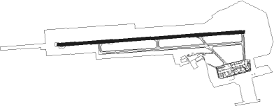
Trieste - Ronchi Dei Legionari
Airport details
| Country | Italy |
| State | Friuli-Venezia Giulia |
| Region | LI |
| Airspace | Milan Ctr |
| Municipality | Ronchi dei Legionari |
| Elevation | 37ft (11m) |
| Timezone | GMT +1 |
| Coordinates | 45.82473, 13.47382 |
| Magnetic var | |
| Type | land |
| Available since | X-Plane v10.40 |
| ICAO code | LIPQ |
| IATA code | TRS |
| FAA code | n/a |
Communication
| Ronchi Dei Legionari Tower | 130.250 |
| Ronchi Dei Legionari Approach | 119.175 |
Approach frequencies
| ILS-cat-II | RW09 | 110.75 | 18.00mi |
| 3° GS | RW09 | 110.75 | 18.00mi |
Nearby Points of Interest:
Rilke trail
-St. George's Parish Church
-Palmanova
-Palmanova Fortress
-Corroninijeva vila
-Palazzo Coronini Cronberg
-Co-Cathedral of Christ the Saviour, Nova Gorica
-St. Andrew's Parish Church (Prvačina)
-Nova Gorica
-Duino Mithraeum
-St. Martin's Parish Church
-Longobards in Italy, Places of Power
-Ancient Roman architecture in Trieste
-Assumption of Mary Parish Church
-Debeli Rtič
-Cerkev svetega Kancijana, Britof
-Sežana
-Assumption of Mary Church
-St. Lawrence's Parish Church
-Bohinj Railway
-St. Donatus's Church
-Venetian House
-Piran Town Hall
-St. Mary the Comforter Church
-Tartini House
Runway info
| Runway 09 / 27 | ||
| length | 2991m (9813ft) | |
| bearing | 90° / 270° | |
| width | 45m (148ft) | |
| surface | asphalt | |
| displ threshold | 197m (646ft) / 0m (0ft) | |
| blast zone | 0m (0ft) / 64m (210ft) | |
Nearby beacons
| code | identifier | dist | bearing | frequency |
|---|---|---|---|---|
| RCH | RONCHI DEI LEGIONARI VOR/DME | 0.4 | 52° | 114.20 |
| RON | RONCHI DEI LEGIONARI NDB | 4.7 | 272° | 396 |
| RIV | RIVOLTO TACAN | 19.1 | 294° | 110 |
| PZ | PORTOROZ NDB | 21.6 | 158° | 388 |
| POR | PORTOROZ VOR/DME | 21.8 | 158° | 115.15 |
| RIV | RIVOLTO NDB | 23.2 | 282° | 371 |
| ILB | BISTRICA VOR/DME | 33.1 | 110° | 114.80 |
| VRS | VRSAR NDB | 37.6 | 164° | 369 |
| AVI | AVIANO TACAN | 39 | 283° | 116.40 |
| BRZ | BREZA NDB | 43.8 | 115° | 400 |
| LBL | LJUBLJANA VOR/DME | 46.9 | 67° | 117.20 |
| KO | KOZALA (RIJEKA) NDB | 50.3 | 117° | 438 |
| VIW | DME | 55.4 | 27° | 112.90 |
| PLA | PULA NDB | 57.4 | 163° | 351 |
| GS | PULA NDB | 58.2 | 158° | 420 |
| VL | VALTURA NDB | 58.6 | 156° | 320 |
| PUL | PULA VOR/DME | 59 | 155° | 111.25 |
| KAV | KAVRAN NDB | 60.1 | 150° | 265 |
| KI | KLAGENFURT NDB | 61.5 | 48° | 313 |
| CRE | CRES NDB | 68.1 | 134° | 433 |
Departure and arrival routes
| Transition altitude | 5000ft |
| SID end points | distance | outbound heading | |
|---|---|---|---|
| RW09 | |||
| ROSK5E, ROSK8B | 40mi | 230° | |
| TIBR9B, TIBR6E | 24mi | 360° | |
| RW27 | |||
| ROSK5C, ROSK8B | 40mi | 230° | |
| TIBR6F, TIBR9B | 24mi | 360° | |
| STAR starting points | distance | inbound heading | |
|---|---|---|---|
| ALL | |||
| TIBR2C, TIBR2E, TIBR3D, TIBR4B | 23.6 | 180° | |
Instrument approach procedures
| runway | airway (heading) | route (dist, bearing) |
|---|---|---|
| RW09-Y | RON (92°) | RON 5000ft PQ512 (5mi, 181°) 5000ft PQ513 (6mi, 270°) 4000ft PQ401 (5mi, 0°) 3000ft |
| RNAV | PQ401 3000ft LEIRA (4mi, 90°) 2230ft LIPQ (8mi, 91°) 87ft PQ522 (2mi, 87°) 620ft PQ523 (5mi, 204°) NIORR (3mi, 248°) NIORR (turn) 3000ft | |
| RW09-Z | RON (92°) | RON 5000ft PQ512 (5mi, 181°) 5000ft PQ513 (6mi, 270°) 4000ft PQ401 (5mi, 0°) 3000ft |
| RNAV | PQ401 3000ft LEIRA (4mi, 90°) 2230ft LIPQ (8mi, 91°) 87ft PQ523 (5mi, 172°) NIORR (3mi, 248°) NIORR (turn) 3000ft |
Holding patterns
| STAR name | hold at | type | turn | heading* | altitude | leg | speed limit |
|---|---|---|---|---|---|---|---|
| CHI1E | LEIRA | VHF | left | 268 (88)° | 3000ft - 5000ft | DME 3.5mi | 185 |
| CHI1H | LEIRA | VHF | left | 268 (88)° | 3000ft - 5000ft | DME 3.5mi | 185 |
| CHI1L | LEIRA | VHF | left | 268 (88)° | 3000ft - 5000ft | DME 3.5mi | 185 |
| CHI1L | RON | FIX | right | 268 (88)° | 3000ft - 5000ft | 1.0min timed | 185 |
| CHI1M | RON | FIX | right | 268 (88)° | 3000ft - 5000ft | 1.0min timed | 185 |
| CHI1N | LEIRA | VHF | left | 268 (88)° | 3000ft - 5000ft | DME 3.5mi | 185 |
| CHI1N | RON | FIX | right | 268 (88)° | 3000ft - 5000ft | 1.0min timed | 185 |
| CHI4P | RON | FIX | right | 268 (88)° | 3000ft - 5000ft | 1.0min timed | 185 |
| NIOR1A | RON | FIX | right | 268 (88)° | 3000ft - 5000ft | 1.0min timed | 185 |
| NIOR1B | LEIRA | VHF | left | 268 (88)° | 3000ft - 5000ft | DME 3.5mi | 185 |
| NIOR1B | RON | FIX | right | 268 (88)° | 3000ft - 5000ft | 1.0min timed | 185 |
| RCH1C | LEIRA | VHF | left | 268 (88)° | 3000ft - 5000ft | DME 3.5mi | 185 |
| RCH1C | RON | FIX | right | 268 (88)° | 3000ft - 5000ft | 1.0min timed | 185 |
| RCH2B | RON | FIX | right | 268 (88)° | 3000ft - 5000ft | 1.0min timed | 185 |
| RIFE1C | LEIRA | VHF | left | 268 (88)° | 3000ft - 5000ft | DME 3.5mi | 185 |
| RIFE2B | RON | FIX | right | 268 (88)° | 3000ft - 5000ft | 1.0min timed | 185 |
| TIBR2C | RON | FIX | right | 268 (88)° | 3000ft - 5000ft | 1.0min timed | 185 |
| TIBR2E | LEIRA | VHF | left | 268 (88)° | 3000ft - 5000ft | DME 3.5mi | 185 |
| TIBR3D | LEIRA | VHF | left | 268 (88)° | 3000ft - 5000ft | DME 3.5mi | 185 |
| TIBR3D | RON | FIX | right | 268 (88)° | 3000ft - 5000ft | 1.0min timed | 185 |
| TIBR4B | RON | FIX | right | 268 (88)° | 3000ft - 5000ft | 1.0min timed | 185 |
| *) magnetic outbound (inbound) holding course | |||||||
Disclaimer
The information on this website is not for real aviation. Use this data with the X-Plane flight simulator only! Data taken with kind consent from X-Plane 12 source code and data files. Content is subject to change without notice.