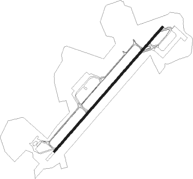
Verona Villafranca
Airport details
| Country | Italy |
| State | Veneto |
| Region | LI |
| Airspace | Milan Ctr |
| Municipality | Sommacampagna |
| Elevation | 240ft (73m) |
| Timezone | GMT +1 |
| Coordinates | 45.39639, 10.88778 |
| Magnetic var | |
| Type | land |
| Available since | X-Plane v10.40 |
| ICAO code | LIPX |
| IATA code | VRN |
| FAA code | n/a |
Communication
| Verona Villafranca ATIS | 124.125 |
| Verona Villafranca Ground Control | 121.750 |
| Verona Villafranca Tower | 118.650 |
| Verona Villafranca Verona Approach | 118.550 |
| Verona Villafranca Garda Radar | 124.250 |
Approach frequencies
| ILS-cat-III | RW04 | 111.75 | 18.00mi |
| 3° GS | RW04 | 111.75 | 18.00mi |
Nearby Points of Interest:
Domus romana di piazza Castelvecchio
-Verona
-San Domenico al Corso
-Capitular Library of Verona
-Colà
-Monzambano
-Ponti sul Mincio
-Fortified city of Peschiera del Garda
-Archeological Museum of Isola della Scala
-Dogana veneta
-Villa Del Bene
-Fondo Tacoli pile-dwelling site
-Sirmione
-Rocca di Garda
-Goito
-Santa Maria Addolorata e San Giovanni Battista
-Solferino
-Guidizzolo
-castello di Orazio Gonzaga
-Sant'Anna Church
-Palazzo Cavriani
-National Archives Mantua
-Palazzo Andreani
-Galleria arte e arti della Camera di commercio di Mantova
-Giovanni Rambotti Civic Archaeological Museum
Nearby beacons
| code | identifier | dist | bearing | frequency |
|---|---|---|---|---|
| VIL | VILLAFRANCA VORTAC | 1 | 58° | 115.80 |
| BSA | BRESCIA VOR/DME | 24.2 | 274° | 117.70 |
| GHE | GHEDI TACAN | 26.4 | 274° | 110.90 |
| VIC | VICENZA NDB | 36.1 | 73° | 417 |
| VIC | VICENZA VOR/DME | 36.2 | 73° | 113.40 |
| TNT | TRENTO VOR/DME | 38.9 | 22° | 115.35 |
| IPD | DME-ILS | 40.3 | 90° | 111.30 |
| BOA | BOLOGNA VOR/DME | 54.3 | 155° | 117.10 |
Departure and arrival routes
| Transition altitude | 6000ft |
| SID end points | distance | outbound heading | |
|---|---|---|---|
| RW04 | |||
| OTZO5C, OTZO5A | 12mi | 65° | |
| TUVD5B, TUVD5A | 15mi | 106° | |
| ECVA5A | 21mi | 118° | |
| ITEF5A | 23mi | 127° | |
| UPCA5A | 23mi | 135° | |
| AGUF5A | 23mi | 139° | |
| OSBU5G, OSBU5M | 43mi | 226° | |
| COD5S, COD5G | 58mi | 263° | |
| LEGL5S, LEGL5G | 49mi | 283° | |
| RW22 | |||
| OTZO5B | 12mi | 65° | |
| TUVD5C | 15mi | 106° | |
| ITEF5B | 23mi | 127° | |
| AGUF5B | 23mi | 139° | |
| OSBU5W | 43mi | 226° | |
| COD5E | 58mi | 263° | |
| LEGL5U | 49mi | 283° | |
| STAR starting points | distance | inbound heading | |
|---|---|---|---|
| RW04 | |||
| OSBU2J, OSBU2X | 42.7 | 46° | |
| TZO2J, TZO2B | 58.8 | 97° | |
| SRN2B | 79.8 | 98° | |
| NEVN1X, NEVN2J, NEVN2R | 24.7 | 118° | |
| IBCA1A | 13.9 | 126° | |
| OSTE3J, OSTE1X | 16.8 | 311° | |
Instrument approach procedures
| runway | airway (heading) | route (dist, bearing) |
|---|---|---|
| RW04 | ABLID (55°) | ABLID 5000ft GIVAT (5mi, 55°) 4000ft ERMOB (4mi, 56°) 3000ft |
| RW04 | BOLVO (38°) | BOLVO 5000ft GIVAT (5mi, 306°) 4000ft ERMOB (4mi, 56°) 3000ft |
| RW04 | RIVEV (69°) | RIVEV 5000ft GIVAT (5mi, 126°) 4000ft ERMOB (4mi, 56°) 3000ft |
| RNAV | ERMOB 3000ft PEVIK (4mi, 55°) 3000ft LIPX (9mi, 55°) 277ft PX701 (3mi, 57°) 1000ft (2789mi, 194°) UNKAV (2779mi, 14°) 3000ft UNKAV (turn) 3000ft |
Holding patterns
| STAR name | hold at | type | turn | heading* | altitude | leg | speed limit |
|---|---|---|---|---|---|---|---|
| ANJA1A | RIVEV | VHF | right | 44 (224)° | > 5000ft | DME 4.0mi | 210 |
| IBCA1A | PEVIK | VHF | right | 224 (44)° | > 3000ft | DME 3.7mi | 210 |
| NEVN1X | PEVIK | VHF | right | 224 (44)° | > 3000ft | DME 3.7mi | 210 |
| NEVN2J | ABLID | VHF | right | 224 (44)° | > 5000ft | DME 4.0mi | 210 |
| NEVN2R | RIVEV | VHF | right | 44 (224)° | > 5000ft | DME 4.0mi | 210 |
| OSBU2J | ABLID | VHF | right | 224 (44)° | > 5000ft | DME 4.0mi | 210 |
| OSBU2X | GIVAT | VHF | right | 224 (44)° | > 4000ft | DME 4.0mi | 185 |
| OSBU2X | PEVIK | VHF | right | 224 (44)° | > 3000ft | DME 3.7mi | 210 |
| OSTE1X | PEVIK | VHF | right | 224 (44)° | > 3000ft | DME 3.7mi | 210 |
| OSTE3J | BOLVO | VHF | left | 44 (224)° | > 5000ft | DME 4.0mi | 210 |
| PIRW1B | BOLVO | VHF | left | 44 (224)° | > 5000ft | DME 4.0mi | 210 |
| SRN2B | GIVAT | VHF | right | 224 (44)° | > 4000ft | DME 4.0mi | 185 |
| SRN2B | PEVIK | VHF | right | 224 (44)° | > 3000ft | DME 3.7mi | 210 |
| TZO2B | GIVAT | VHF | right | 224 (44)° | > 4000ft | DME 4.0mi | 185 |
| TZO2B | PEVIK | VHF | right | 224 (44)° | > 3000ft | DME 3.7mi | 210 |
| TZO2J | ABLID | VHF | right | 224 (44)° | > 5000ft | DME 4.0mi | 210 |
| XUBK1A | BOLVO | VHF | left | 44 (224)° | > 5000ft | DME 4.0mi | 210 |
| *) magnetic outbound (inbound) holding course | |||||||
Disclaimer
The information on this website is not for real aviation. Use this data with the X-Plane flight simulator only! Data taken with kind consent from X-Plane 12 source code and data files. Content is subject to change without notice.