Salerno - Salerno Pontecagnano
Airport details
| Country | Italy |
| State | Campania |
| Region | LI |
| Airspace | Rome Ctr |
| Municipality | Pontecagnano Faiano |
| Elevation | 128ft (39m) |
| Timezone | GMT +1 |
| Coordinates | 40.62476, 14.91610 |
| Magnetic var | |
| Type | land |
| Available since | X-Plane v10.40 |
| ICAO code | LIRI |
| IATA code | QSR |
| FAA code | n/a |
Communication
| Salerno Pontecagnano Salerno Aerodrome INFO | 119.175 |
| Salerno Pontecagnano Napoli Approach | 124.350 |
Nearby Points of Interest:
parco archeologico urbano dell'antica Picentia
-Archivio di Stato di Salerno
-Oasi naturale del Monte Polveracchio
-Oasi di Persano
-Villa Rufolo
-Diocesan Museum San Prisco
-Amalfi Coast
-Convento dei cappuccini
-Oasi naturale Valle della Caccia
-Archivio di Stato di Avellino
-Museo d'arte sacra (Castellabate)
-Casa dei Cubicoli floreali
-House of Orpheus
-Casa di Laocoonte
-Archaeological Areas of Pompei, Herculaneum and Torre Annunziata
-Sentiero delle Ripe
-house of the Corinthian atrium
-Torre di Montesarchio
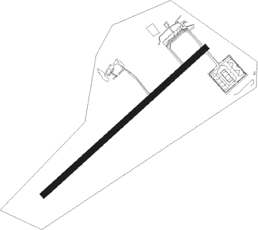
Runway info
| Runway 05 / 23 | ||
| length | 1656m (5433ft) | |
| bearing | 60° / 240° | |
| width | 45m (148ft) | |
| surface | asphalt | |
| displ threshold | 0m (0ft) / 155m (509ft) | |
| blast zone | 58m (190ft) / 0m (0ft) | |
Nearby beacons
| code | identifier | dist | bearing | frequency |
|---|---|---|---|---|
| PTC | PONTECAGNANO (SALERNO) NDB | 0.4 | 244° | 324 |
| SOR | SORRENTO NDB | 26.5 | 266° | 426 |
| SOR | SORRENTO VOR/DME | 26.6 | 266° | 112.20 |
| POM | DME | 30.3 | 300° | 117.85 |
| NAP | (NAPLES) DME-ILS | 32.3 | 293° | 110.95 |
| GRA | GRAZZANISE TACAN | 45.7 | 298° | 117.50 |
| GRA | GRAZZANISE NDB | 45.8 | 298° | 343 |
| FGG | FOGGIA VOR/DME | 55.7 | 37° | 115.80 |
| FOG | FOGGIA NDB | 55.8 | 37° | 340 |
| TEA | TEANO VOR/DME | 58.8 | 305° | 112.90 |
| MNL | AMENDOLA TACAN | 65.5 | 40° | 115.25 |
Departure and arrival routes
| Transition altitude | 8000ft |
| SID end points | distance | outbound heading | |
|---|---|---|---|
| RW05 | |||
| POLI7F, POLI5C | 29mi | 190° | |
| VARA7F, VARA5C | 39mi | 204° | |
| AMAN7F, AMAN5C | 89mi | 223° | |
| PEVI5C, PEVI7F | 47mi | 250° | |
| SOR7F, SOR5C | 27mi | 266° | |
| RW23 | |||
| POLI7F, POLI5C | 29mi | 190° | |
| VARA5C, VARA7F | 39mi | 204° | |
| AMAN5C, AMAN7F | 89mi | 223° | |
| PEVI7F, PEVI5C | 47mi | 250° | |
| SOR5C, SOR7F | 27mi | 266° | |
| STAR starting points | distance | inbound heading | |
|---|---|---|---|
| ALL | |||
| POLI3F | 28.9 | 10° | |
| DIRE3F | 66.2 | 21° | |
| VARA3F | 38.7 | 24° | |
| AMAN3F | 88.7 | 43° | |
| PEVI3F | 46.9 | 70° | |
| SOR3F | 26.5 | 86° | |
| RW05 | |||
| POLI1B | 28.9 | 10° | |
| DIRE1B | 66.2 | 21° | |
| VARA1B | 38.7 | 24° | |
| AMAN1B | 88.7 | 43° | |
| PEVI1B | 46.9 | 70° | |
| SOR1B | 26.5 | 86° | |
Holding patterns
| STAR name | hold at | type | turn | heading* | altitude | leg | speed limit |
|---|---|---|---|---|---|---|---|
| AMAN1B | GIPOR | VHF | right | 226 (46)° | > 4000ft | DME 5.0mi | ICAO rules |
| AMAN3F | GIPOR | VHF | right | 226 (46)° | > 4000ft | DME 5.0mi | ICAO rules |
| DIRE1B | GIPOR | VHF | right | 226 (46)° | > 4000ft | DME 5.0mi | ICAO rules |
| DIRE3F | GIPOR | VHF | right | 226 (46)° | > 4000ft | DME 5.0mi | ICAO rules |
| PEVI1B | GIPOR | VHF | right | 226 (46)° | > 4000ft | DME 5.0mi | ICAO rules |
| PEVI3F | DELER | VHF | left | 305 (125)° | > 8000ft | DME 5.0mi | ICAO rules |
| PEVI3F | GIPOR | VHF | right | 226 (46)° | > 4000ft | DME 5.0mi | ICAO rules |
| POLI1B | GIPOR | VHF | right | 226 (46)° | > 4000ft | DME 5.0mi | ICAO rules |
| POLI3F | GIPOR | VHF | right | 226 (46)° | > 4000ft | DME 5.0mi | ICAO rules |
| SOR1B | GIPOR | VHF | right | 226 (46)° | > 4000ft | DME 5.0mi | ICAO rules |
| SOR3F | GIPOR | VHF | right | 226 (46)° | > 4000ft | DME 5.0mi | ICAO rules |
| VARA1B | GIPOR | VHF | right | 226 (46)° | > 4000ft | DME 5.0mi | ICAO rules |
| VARA3F | GIPOR | VHF | right | 226 (46)° | > 4000ft | DME 5.0mi | ICAO rules |
| *) magnetic outbound (inbound) holding course | |||||||
Disclaimer
The information on this website is not for real aviation. Use this data with the X-Plane flight simulator only! Data taken with kind consent from X-Plane 12 source code and data files. Content is subject to change without notice.