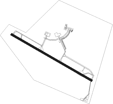
Latina
Airport details
| Country | Italy |
| State | Lazio |
| Region | LI |
| Airspace | Rome Ctr |
| Municipality | Latina |
| Elevation | 91ft (28m) |
| Timezone | GMT +1 |
| Coordinates | 41.54586, 12.90760 |
| Magnetic var | |
| Type | land |
| Available since | X-Plane v10.40 |
| ICAO code | LIRL |
| IATA code | QLT |
| FAA code | n/a |
Communication
| LATINA Tower | 122.100 |
| LATINA Approach | 126.550 |
| LATINA Approach | 122.100 |
Approach frequencies
| ILS-cat-I | RW12 | 110.35 | 18.00mi |
| 3° GS | RW12 | 110.35 | 18.00mi |
Nearby Points of Interest:
Church of Saint Joseph
-Loggia dei Mercanti
-Museo del cioccolato
-Palazzo Comunale
-Ariccia Bridge
-Palazzo Savelli (Albano Laziale)
-chiesa di Santa Margherita
-Livio de Carolis Fountain
-Museo archeologico di Frosinone
-ponte Lupo Acqua Rossa
-San Domenico
-Castello Frangipane
-chiesa di Santa Maria Assunta
-Antiquarium Lucrezia Romana
-Aqua Marcia
-Anio Novus
-Aqua Claudia
-Monastery of Saint Scholastica
-parco archeologico Appia antica - tombe della via Latina
-Museo delle Civiltà
-Palazzo Altemps
-Monumento naturale Grotte di Falvaterra e Rio Obaco
-Ponte di Mezzocammino
-Villa Giustiniani Massimo
-Santa Maria delle Lauretane
Nearby beacons
| code | identifier | dist | bearing | frequency |
|---|---|---|---|---|
| LAT | LATINA VOR/DME | 0.5 | 114° | 111.20 |
| FRS | FROSINONE VOR/DME | 18.2 | 76° | 115.60 |
| TPR | PRATICA DI MARE TACAN | 19.1 | 280° | 108.70 |
| ROM | ROME VOR/DME | 21.1 | 309° | 110.80 |
| URB | URBE (ROME) NDB | 30.3 | 314° | 285 |
| OST | OSTIA VOR/DME | 33.8 | 291° | 114.90 |
| OST | OSTIA NDB | 33.9 | 291° | 327 |
| PNZ | PONZA VORTAC | 38.1 | 176° | 114.60 |
| CMP | CAMPAGNANO VOR/DME | 41.9 | 318° | 111.40 |
| VIB | VITERBO NDB | 65.7 | 316° | 480 |
Departure and arrival routes
| Transition altitude | 6000ft |
| SID end points | distance | outbound heading | |
|---|---|---|---|
| RW12 | |||
| LAT1E, LAT1G | 29mi | 1° | |
| PNZ1B | 38mi | 176° | |
| TPR1D | 19mi | 280° | |
| RW30 | |||
| LAT1D, LAT1F | 29mi | 1° | |
| PNZ1A | 38mi | 176° | |
| TPR1C | 19mi | 280° | |
| STAR starting points | distance | inbound heading | |
|---|---|---|---|
| ALL | |||
| OKDE1S, OKDE1U | 23.3 | 207° | |
| PNZ1S, PNZ1U | 38.1 | 356° | |
Holding patterns
| STAR name | hold at | type | turn | heading* | altitude | leg | speed limit |
|---|---|---|---|---|---|---|---|
| IRDU1S | IRDUN | VHF | left | 133 (313)° | > 4000ft | 1.0min timed | ICAO rules |
| OKDE1S | LAT | NDB | right | 87 (267)° | > 9000ft | DME 5.0mi | 230 |
| OKDE1U | IRDUN | VHF | left | 133 (313)° | > 4000ft | 1.0min timed | ICAO rules |
| OKDE1U | LAT | NDB | right | 87 (267)° | > 9000ft | DME 5.0mi | 230 |
| PNZ1S | LAT | NDB | right | 87 (267)° | > 9000ft | DME 5.0mi | 230 |
| PNZ1U | IRDUN | VHF | left | 133 (313)° | > 4000ft | 1.0min timed | ICAO rules |
| *) magnetic outbound (inbound) holding course | |||||||
Disclaimer
The information on this website is not for real aviation. Use this data with the X-Plane flight simulator only! Data taken with kind consent from X-Plane 12 source code and data files. Content is subject to change without notice.
