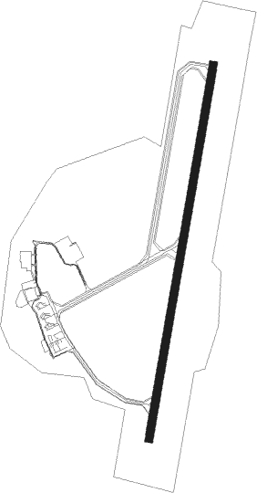
Perugia
Airport details
| Country | Italy |
| State | Umbria |
| Region | LI |
| Airspace | Rome Ctr |
| Municipality | Perugia |
| Elevation | 687ft (209m) |
| Timezone | GMT +1 |
| Coordinates | 43.09722, 12.51028 |
| Magnetic var | |
| Type | land |
| Available since | X-Plane v10.40 |
| ICAO code | LIRZ |
| IATA code | PEG |
| FAA code | n/a |
Communication
Approach frequencies
| ILS-cat-I | RW01 | 110.95 | 18.00mi |
| 3.4° GS | RW01 | 110.95 | 18.00mi |
Nearby Points of Interest:
Collegio della Mercanzia
-Fiume Tescio (parte alta)
-San Girolamo
-City hall
-Oratorio della Nunziatella
-Santa Illuminata, Massa Martana
-Sant'Emiliano in Congiuntoli
-torrione di Porta Caetana
-San Silvestro
-Museo delle Arti Monastiche
-Sezione di Archivio di Stato di Spoleto
-Museo archeologico (Spoleto)
-Santo Stefano
-Chiesa di San Francesco
-Sodo archaeologic area and Camucia's tomb
-Convento di San Francesco
-Santa Maria Assunta
-Santa Vittoria
-Pozzo di S. Patrizio
-Chiesa del Suffragio
-San Michele Arcangelo
-Orvieto
-Monte Cetona
Nearby beacons
| code | identifier | dist | bearing | frequency |
|---|---|---|---|---|
| PRU | PERUGIA NDB | 0.2 | 5° | 398 |
| VIB | VITERBO NDB | 44.2 | 215° | 480 |
| FAL | FALCONARA (ANCONA) TACAN | 44.9 | 59° | 109.80 |
| FAL | FALCONARA (ANCONA) NDB | 49.3 | 58° | 357 |
| ANC | ANCONA VOR/DME | 51.2 | 63° | 110.65 |
| RIM | RIMINI VORTAC | 55.3 | 7° | 116.20 |
| RMN | (RIMINI) DME | 55.4 | 7° | 108.80 |
| CMP | CAMPAGNANO VOR/DME | 58.7 | 188° | 111.40 |
| RIM | RIMINI NDB | 58.9 | 360° | 335 |
| TAQ | TARQUINIA VOR/DME | 63.1 | 221° | 111.80 |
Departure and arrival routes
| Transition altitude | 6000ft |
| SID end points | distance | outbound heading | |
|---|---|---|---|
| RW01 | |||
| GITO6Y, GITO6G | 20mi | 214° | |
| LAKO5X, LAKO6G, LAKO6Y | 18mi | 278° | |
| RW19 | |||
| GITO6F, GITO6W | 20mi | 214° | |
| LAKO5W, LAKO6F | 18mi | 278° | |
| STAR starting points | distance | inbound heading | |
|---|---|---|---|
| RW01 | |||
| GITO1M, GITO2B, GITO2L | 19.8 | 34° | |
| RETK1B | 12.8 | 76° | |
| LAKO1A, LAKO1B, LAKO1L, LAKO1M | 17.9 | 98° | |
Holding patterns
| STAR name | hold at | type | turn | heading* | altitude | leg | speed limit |
|---|---|---|---|---|---|---|---|
| GITO1M | PRU | NDB | right | 1 (181)° | > 6000ft | 1.0min timed | 200 |
| GITO2L | DERUX | VHF | right | 193 (13)° | 5000ft - 10000ft | DME 4.0mi | 210 |
| KATA1A | PRU | NDB | right | 1 (181)° | > 6000ft | 1.0min timed | 200 |
| KATA1H | PRU | NDB | right | 1 (181)° | > 6000ft | 1.0min timed | 200 |
| KATA1L | DERUX | VHF | right | 193 (13)° | 5000ft - 10000ft | DME 4.0mi | 210 |
| KATA1L | PRU | NDB | right | 1 (181)° | > 6000ft | 1.0min timed | 200 |
| KATA1M | PRU | NDB | right | 1 (181)° | > 6000ft | 1.0min timed | 200 |
| LAKO1A | PRU | NDB | right | 1 (181)° | > 6000ft | 1.0min timed | 200 |
| LAKO1L | DERUX | VHF | right | 193 (13)° | 5000ft - 10000ft | DME 4.0mi | 210 |
| LAKO1M | PRU | NDB | right | 1 (181)° | > 6000ft | 1.0min timed | 200 |
| *) magnetic outbound (inbound) holding course | |||||||
Disclaimer
The information on this website is not for real aviation. Use this data with the X-Plane flight simulator only! Data taken with kind consent from X-Plane 12 source code and data files. Content is subject to change without notice.
