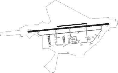
Cerklje Ob Krki - Cerklje Pri Krki
Airport details
| Country | Slovenia |
| State | Brezice |
| Region | LJ |
| Airspace | Ljubljana Ctr |
| Municipality | Brežice |
| Elevation | 507ft (155m) |
| Timezone | GMT +1 |
| Coordinates | 45.90092, 15.54385 |
| Magnetic var | |
| Type | land |
| Available since | X-Plane v10.40 |
| ICAO code | LJCE |
| IATA code | n/a |
| FAA code | n/a |
Communication
| Cerklje pri Krki FIS | 118.475 |
| Cerklje pri Krki Tower | 119.500 |
| Cerklje pri Krki Approach | 118.750 |
| Cerklje pri Krki Departure | 118.750 |
Approach frequencies
| ILS-cat-I | RW09 | 111.1 | 18.00mi |
| 3° GS | RW09 | 111.1 | 18.00mi |
Nearby Points of Interest:
Brežice
-Brežice Water Tower
-Neviodunum
-Straža Mansion
-Our Lady of Sorrows Church
-Šrajbarski Turn Castle
-Gračeno Castle
-Holy Name of Mary Parish Church (Dobova)
-Church of Saint James the Greater
-St. Barbara's Church
-St. Bartholomew's Church
-Jovsi
-St. James's Parish Church
-Our Lady of Lourdes Basilica, Brestanica
-Kostanjevica na Krki monastery
-Holy Cross Church (Dednja Vas)
-St. Ulrich's Church
-St. Gertrude's Church
-St. Andrew's Church (Dramlja)
-Gutenwerth
-Reštanj Castle
-Holy Trinity Chuch
-Our Lady of the Rosary Church
-Dolnja Stara vas
-Kozje Castle
Runway info
Runway 09 / 27  | ||
| length | 2992m (9816ft) | |
| bearing | 89° / 269° | |
| width | 45m (148ft) | |
| surface | asphalt | |
| blast zone | 59m (194ft) / 57m (187ft) | |
| Runway 09L / 27R | ||
| length | 1089m (3573ft) | |
| bearing | 89° / 269° | |
| width | 30m (98ft) | |
| surface | grass | |
Nearby beacons
| code | identifier | dist | bearing | frequency |
|---|---|---|---|---|
| COK | CERKLJE VOR/DME | 0.9 | 271° | 108.25 |
| CL | CERKLJE-HRASTJE NDB | 1.9 | 268° | 463 |
| RK | CERKLJE-RAKA NDB | 6.3 | 269° | 359 |
| JAP | DME | 9.7 | 158° | 117.65 |
| PIS | PISAROVINA NDB | 21.7 | 135° | 424 |
| LUK | DME | 22.6 | 115° | 109.85 |
| VG | VELIKA GORICA (ZAGREB) NDB | 23.3 | 109° | 325 |
| SK | S.KRALJEVEC (ZAGREB) NDB | 26.5 | 99° | 350 |
| MR | MARIBOR NDB | 30.1 | 28° | 334 |
| ZAG | ZAGREB VOR/DME | 31.8 | 90° | 113.70 |
| ZAG | ZAGREB NDB | 32 | 90° | 367 |
| DOL | DOLSKO VOR/DME | 33.7 | 283° | 112.70 |
| MI | OREHOVA VAS (MARIBOR) NDB | 34.3 | 16° | 355 |
| TNJ | TOUNJ NDB | 40 | 197° | 316 |
| VAR | VARAZDIN NDB | 42.4 | 64° | 344 |
| MG | LJUBLJANA NDB | 44.3 | 285° | 296 |
| RJK | RIJEKA VOR/DME | 57.7 | 235° | 117.80 |
| KOS | KOSTAJNICA NDB | 58 | 124° | 316 |
| KOR | DME | 58.2 | 327° | 109.40 |
| KFT | KLAGENFURT VOR/DME | 58.4 | 305° | 113.10 |
| STK | KOGEL DME | 58.9 | 22° | 114.55 |
| RI | RIJEKA (KRK ISLAND) NDB | 59.2 | 229° | 289 |
| GBG | GLEICHENBERG NDB | 60.1 | 15° | 426 |
Departure and arrival routes
| Transition altitude | 10500ft |
| SID end points | distance | outbound heading | |
|---|---|---|---|
| RW09 | |||
| OTMO1E | 27mi | 256° | |
| RW27 | |||
| OTMO1D | 27mi | 256° | |
| STAR starting points | distance | inbound heading | |
|---|---|---|---|
| RW09 | |||
| ZARV1A | 24.9 | 89° | |
Disclaimer
The information on this website is not for real aviation. Use this data with the X-Plane flight simulator only! Data taken with kind consent from X-Plane 12 source code and data files. Content is subject to change without notice.