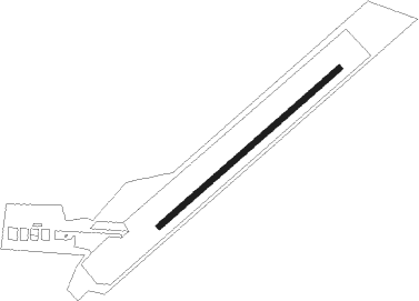
Cheb
Airport details
| Country | Czechia |
| State | Northwest |
| Region | LK |
| Airspace | Prague Ctr |
| Municipality | Cheb |
| Elevation | 1583ft (482m) |
| Timezone | GMT +1 |
| Coordinates | 50.06639, 12.41278 |
| Magnetic var | |
| Type | land |
| Available since | X-Plane v11.20 |
| ICAO code | LKCB |
| IATA code | n/a |
| FAA code | n/a |
Communication
| Cheb unnamed entity | 122.200 |
Nearby Points of Interest:
Náměstí Krále Jiřího z Poděbrad 17
-Town hall in Cheb
-Březinova 6
-Náměstí Krále Jiřího z Poděbrad 31
-Poor Clares convent in Cheb
-Pachelbelův dům
-Maria Loreta, Starý Hrozňatov
-Church of Holy Trinity
-Chapel of Saint Mary Magdalene
-Church of Saint Lawrence
-Lázeňský dům Imperiál
-Church of Saint Oswald
-Lázeňský dům Tři lilie
-Františkovy Lázně
-Church of Saint Anne
-Vodní mlýn čp. 9
-Church of Saint James the Greater
-Kamenný Dvůr Chateau
-Kynšperk nad Ohří Castle
-Jewish cemetery in Kynšperk nad Ohří
-Waldsassen Abbey
-Town hall in Kynšperk nad Ohří
-Kaceřov
-Church of Saint Wolfgang (Ostroh)
-Chapel of Virgin Mary
Nearby beacons
| code | identifier | dist | bearing | frequency |
|---|---|---|---|---|
| OKG | CHEB VOR/DME | 0.2 | 260° | 115.70 |
| L | VRATA (KARLOVY VARY) NDB | 21.7 | 76° | 365 |
| GRW | GRAFENWOHR NDB | 28.8 | 232° | 405 |
| GRF | GRAFENWOHR TACAN | 29 | 232° | 111.80 |
| BAY | BAYREUTH VOR | 30.3 | 264° | 110.60 |
| AGD | DME | 55.1 | 6° | 115.30 |
| HFX | HOHENFELS NDB | 55.2 | 213° | 286 |
| ABU | ALTENBURG NDB | 55.8 | 7° | 330 |
Disclaimer
The information on this website is not for real aviation. Use this data with the X-Plane flight simulator only! Data taken with kind consent from X-Plane 12 source code and data files. Content is subject to change without notice.
