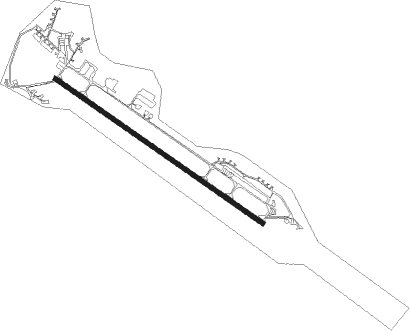
Náměšť - Namest
Airport details
| Country | Czechia |
| State | Southeast |
| Region | LK |
| Airspace | Prague Ctr |
| Municipality | Sedlec |
| Elevation | 1546ft (471m) |
| Timezone | GMT +1 |
| Coordinates | 49.16617, 16.12433 |
| Magnetic var | |
| Type | land |
| Available since | X-Plane v10.40 |
| ICAO code | LKNA |
| IATA code | n/a |
| FAA code | n/a |
Communication
| Namest Tower | 121.850 |
| Namest Tower | 126.250 |
| Namest Approach | 120.225 |
| Namest PRECISION | 123.300 |
Approach frequencies
| ILS-cat-I | RW30 | 111.35 | 18.00mi |
| 3° GS | RW30 | 111.35 | 18.00mi |
Nearby Points of Interest:
Church of Saint Giles
-Haugwitz crypt in Náměšť nad Oslavou
-Church of Saints Peter and Paul
-Church of Our Lady of the Angel
-Church of Saint Bartholomew (Koněšín)
-Valeč Castle
-Church of Saint Martin (Kralice nad Oslavou)
-Church of Saint James the Greater
-Church of Saint Lawrence
-Schönwald
-Dolní hrádek
-Church of Saints Peter and Paul in Jinošov
-Church of Saint Wenceslaus in Račice
-Church of Saint Catherine of Alexandria
-Church of Saint Clemens
-Krhov Castle
-kostel svatého Jakuba Staršího
-Bell tower in Stanoviště
-Myslibořice Castle
-Church of Saint Luke in Myslibořice
-kostel svatého Václava
-Rešice Castle
-Tasov
-Church of Fourteen Holy Helpers
Nearby beacons
| code | identifier | dist | bearing | frequency |
|---|---|---|---|---|
| X | NAMEST NDB | 1.3 | 298° | 362 |
| L | NAMEST NDB | 1.4 | 118° | 362 |
| LA | NAMEST NDB | 2.8 | 118° | 514 |
| XU | NAMEST NDB | 2.9 | 298° | 563 |
| BNO | BRNO VOR/DME | 22.3 | 92° | 114.45 |
| B | BOREK (BRNO) NDB | 23.6 | 92° | 429 |
| OKF | DESNA VOR/DME | 25.6 | 251° | 113.15 |
| STO | STOCKERAU VOR/DME | 45.1 | 188° | 113 |
| TUN | TULLN NDB | 51.7 | 190° | 358 |
| CF | CASLAV NDB | 51.8 | 317° | 345 |
| PK | PARDUBICE NDB | 52.1 | 340° | 432 |
| P | PARDUBICE NDB | 52.6 | 337° | 888 |
| WGM | WAGRAM VOR/DME | 52.6 | 156° | 112.20 |
| C | CASLAV NDB | 53.5 | 316° | 715 |
| F | CASLAV NDB | 56.2 | 316° | 715 |
| STE | STEINHOF NDB | 57.5 | 173° | 293 |
Departure and arrival routes
| Transition altitude | 5000ft |
| SID end points | distance | outbound heading | |
|---|---|---|---|
| RW12 | |||
| BNO2F | 22mi | 92° | |
| OKF2F | 26mi | 251° | |
| BODA2F | 22mi | 311° | |
| RW30 | |||
| BNO2W | 22mi | 92° | |
| OKF4W | 26mi | 251° | |
| BODA4W | 22mi | 311° | |
| STAR starting points | distance | inbound heading | |
|---|---|---|---|
| RW12 | |||
| OKF6K | 25.6 | 71° | |
| BODA6K | 22.3 | 131° | |
| BNO3K | 22.3 | 272° | |
| RW30 | |||
| OKF3H | 25.6 | 71° | |
| BODA2H | 22.3 | 131° | |
| BNO2H | 22.3 | 272° | |
Disclaimer
The information on this website is not for real aviation. Use this data with the X-Plane flight simulator only! Data taken with kind consent from X-Plane 12 source code and data files. Content is subject to change without notice.
