Rakovnik
Airport details
| Country | Czechia |
| State | Central Bohemia |
| Region | LK |
| Airspace | Prague Ctr |
| Municipality | Rakovník |
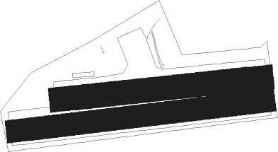
| Elevation | 1270ft (387m) |
| Timezone | GMT +1 |
| Coordinates | 50.09417, 13.68889 |
| Magnetic var | |
| Type | land |
| Available since | X-Plane v10.40 |
| ICAO code | LKRK |
| IATA code | n/a |
| FAA code | n/a |
Communication
| Rakovnik INFO | 123.500 |
Nearby Points of Interest:
Sokol house in Rakovník
-Villa Lexa
-Křížová cesta (Olešná)
-Olešná
-Hlavačov
-Fortified house in Pšovlky
-Kostel svatých Petra a Pavla
-Kolešovice Castle
-Synagogue in Zderaz
-Church of Saint Stephen in Skřivaň
-Jewish cemetery in Zderaz
-Kostel svatého Václava
-Church of Saint Procopius
-Hradiště nad Javornicí
-Dub
-Church of Saint John the Baptist
-Chapel of Saint Anne
-Kouřimecká Rybárna
-Church of Saint Wenceslaus
-mlýn a malá vodní elektrárna ve Šlovicích
-Domoušice
-Church of Saint Martin
-Hluboký
-Šprymberk
-Church of Saint Nicholas

Nearby beacons
| code | identifier | dist | bearing | frequency |
|---|---|---|---|---|
| OKL | PRAGUE VOR/DME | 22.2 | 90° | 112.60 |
| PSK | DME | 22.8 | 132° | 117.60 |
| L | LIBOC (PRAGUE) NDB | 23 | 88° | 372 |
| V | MASLOVICE (VODOCHODY) NDB | 27.4 | 80° | 416 |
| L | VRATA (KARLOVY VARY) NDB | 29.3 | 278° | 365 |
| K | KBELY NDB | 33.9 | 88° | 438 |
| KD | KBELY NDB | 36.6 | 86° | 300 |
| NER | NERATOVICE VOR/DME | 39.3 | 74° | 112.25 |
| DRN | DRESDEN VOR/DME | 55.4 | 354° | 114.35 |
| HDO | HERMSDORF VOR/DME | 56.4 | 39° | 108.65 |
Disclaimer
The information on this website is not for real aviation. Use this data with the X-Plane flight simulator only! Data taken with kind consent from X-Plane 12 source code and data files. Content is subject to change without notice.