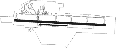
Brno - Brno–tuřany
Airport details
| Country | Czechia |
| State | Southeast |
| Region | LK |
| Airspace | Prague Ctr |
| Municipality | Brno |
| Elevation | 774ft (236m) |
| Timezone | GMT +1 |
| Coordinates | 49.15370, 16.68834 |
| Magnetic var | |
| Type | land |
| Available since | X-Plane v10.40 |
| ICAO code | LKTB |
| IATA code | BRQ |
| FAA code | n/a |
Communication
| Brno–Tuřany Turany ATIS | 131.100 |
| Brno–Tuřany Turany GROUND | 125.425 |
| Brno–Tuřany Turany Tower | 119.600 |
| Brno–Tuřany Brno Approach/Radar | 127.350 |
Approach frequencies
| ILS-cat-I | RW27 | 111.5 | 18.00mi |
| 3° GS | RW27 | 111.5 | 18.00mi |
Nearby Points of Interest:
Brněnské Ivanovice Castle
-Bell tower in Brno-Slatina
-Scholasterie ve Šlapanicích
-Former railway line Brno - Líšeň
-Zderad Column
-Church of Saint Gotthard
-Church of Saint Cunigunde
-Viadukt Křenová
-Honorary burial ground at the Central Cemetery in Brno
-Vídeňský viadukt
-Main post office in Brno
-Monastery of Premonstratensians
-Riunione Adriatica di Sicurtà palace
-Penitentiary in Brno
-Franciscan monastery
-Ursulines monastery
-Palace Moravia
-Monastery of Minorits (Brno)
-Merkurova kašna
-Gallery of Orlí
-Obchodní dům Centrum
-Worker's Accident Insurance Company for Moravia and Silesia in Brno
-City walls of Brno
-Alfa Palace
-Klein's palace
Nearby beacons
| code | identifier | dist | bearing | frequency |
|---|---|---|---|---|
| BNO | BRNO VOR/DME | 0.2 | 131° | 114.45 |
| B | BOREK (BRNO) NDB | 1.5 | 98° | 429 |
| LA | NAMEST NDB | 20 | 268° | 514 |
| L | NAMEST NDB | 21 | 270° | 362 |
| X | NAMEST NDB | 23.2 | 273° | 362 |
| XU | NAMEST NDB | 24.5 | 274° | 563 |
| KNE | KUNOVICE NDB | 30.7 | 98° | 434 |
| KUN | KUNOVICE NDB | 32 | 93° | 416 |
| WGM | WAGRAM VOR/DME | 50.4 | 193° | 112.20 |
| STO | STOCKERAU VOR/DME | 51.5 | 222° | 113 |
| TUN | TULLN NDB | 57.9 | 220° | 358 |
| STE | STEINHOF NDB | 59.2 | 205° | 293 |
| OKR | STEFANIK NORTH NDB | 60.7 | 147° | 391 |
| PK | PARDUBICE NDB | 61.7 | 314° | 432 |
| P | PARDUBICE NDB | 62.7 | 313° | 888 |
| JAN | JANOVCE VOR/DME | 67.6 | 139° | 110.80 |
Departure and arrival routes
| Transition altitude | 5000ft |
| SID end points | distance | outbound heading | |
|---|---|---|---|
| RW09 | |||
| UPLA1D | 34mi | 79° | |
| ODNE1D | 26mi | 122° | |
| MIKO4D | 22mi | 190° | |
| TUMK2D | 33mi | 289° | |
| RW27 | |||
| UPLA1A, UPLA1B | 34mi | 79° | |
| ODNE3A | 26mi | 122° | |
| MIKO2A | 22mi | 190° | |
| TUMK3A | 33mi | 289° | |
| STAR starting points | distance | inbound heading | |
|---|---|---|---|
| RW09 | |||
| TUMK3R | 32.8 | 109° | |
| UPLA1R | 34.4 | 259° | |
| MAVO3R, MAVO4Q | 38.9 | 291° | |
| LEDV2R, LEDV3Q | 25.8 | 347° | |
| RW27 | |||
| TUMK4C | 32.8 | 109° | |
| UPLA1C | 34.4 | 259° | |
| MAVO3C | 38.9 | 291° | |
| LEDV2C | 25.8 | 347° | |
Instrument approach procedures
| runway | airway (heading) | route (dist, bearing) |
|---|---|---|
| RW09 | BNO (311°) | BNO TB471 (6mi, 275°) TB472 (6mi, 303°) 3000ft ROGAD (4mi, 212°) 3000ft |
| RNAV | ROGAD 3000ft TB09F (4mi, 95°) 3000ft LKTB (7mi, 94°) 813ft (3075mi, 199°) 4000ft (turn) | |
| RW27 | BNO (311°) | BNO TB501 (8mi, 126°) 3000ft TB502 (7mi, 95°) 3000ft BUKAP (5mi, 12°) 3000ft |
| RNAV | BUKAP 3000ft TB27F (5mi, 275°) 3000ft LKTB (8mi, 276°) 820ft (3075mi, 199°) 4000ft (turn) |
Disclaimer
The information on this website is not for real aviation. Use this data with the X-Plane flight simulator only! Data taken with kind consent from X-Plane 12 source code and data files. Content is subject to change without notice.

