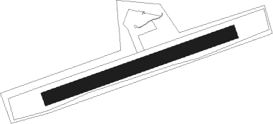
Toužim - Touzim
Airport details
| Country | Czechia |
| State | Northwest |
| Region | LK |
| Airspace | Prague Ctr |
| Municipality | Útvina |
| Elevation | 2133ft (650m) |
| Timezone | GMT +1 |
| Coordinates | 50.08639, 12.95278 |
| Magnetic var | |
| Type | land |
| Available since | X-Plane v10.40 |
| ICAO code | LKTO |
| IATA code | n/a |
| FAA code | n/a |
Communication
| Touzim INFO | 122.600 |
Nearby Points of Interest:
Church of Saint Bartholomew (Přílezy)
-Church of Saint Lawrence
-Church of the Assumption of the Virgin Mary in Kozlov
-Bečovsko
-Reliquary of St. Maurus
-Church of Saints James
-Hotel Central
-Church of Saint Michael (Brložec)
-Chapel of Saint Procopius
-Hungerberg
-Saint Lawrence church
-Jewish cemetery in Poutnov
-Chapel of Saint John of Nepomuk in Ležnice
-Údrč
-Church of Saint Blaise (Branišov)
-Prohořský hrádek
-Stružná Castle
-Chapel of Corpus Christi
-Church of Saint George in Horní Slavkov
-Štědrá Castle
-Town hall in Krásno
-Krásenský vrch
-Church of Saint Anne in Horní Slavkov
-Church of Holy Trinity (Andělská Hora)
-Holy Trinity Church in Nová Ves
Runway info
| Runway 08 / 26 | ||
| length | 1285m (4216ft) | |
| bearing | 80° / 260° | |
| width | 90m (295ft) | |
| surface | grass | |
Nearby beacons
| code | identifier | dist | bearing | frequency |
|---|---|---|---|---|
| L | VRATA (KARLOVY VARY) NDB | 6.5 | 354° | 365 |
| OKG | CHEB VOR/DME | 21.1 | 268° | 115.70 |
| AGD | DME | 56.3 | 334° | 115.30 |
| ABU | ALTENBURG NDB | 56.9 | 335° | 330 |
| DRN | DRESDEN VOR/DME | 61 | 35° | 114.35 |
Disclaimer
The information on this website is not for real aviation. Use this data with the X-Plane flight simulator only! Data taken with kind consent from X-Plane 12 source code and data files. Content is subject to change without notice.
