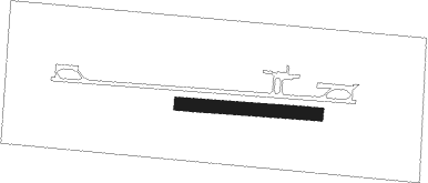
Zabreh
Airport details
| Country | Czechia |
| State | Moravia-Silesia |
| Region | LK |
| Airspace | Prague Ctr |
| Municipality | Dolní Benešov |
| Elevation | 791ft (241m) |
| Timezone | GMT +1 |
| Coordinates | 49.92833, 18.07833 |
| Magnetic var | |
| Type | land |
| Available since | X-Plane v10.40 |
| ICAO code | LKZA |
| IATA code | ZBE |
| FAA code | n/a |
Communication
| Zabreh INFO | 123.600 |
Nearby Points of Interest:
Church of Saint Stanislaus
-Church of Saint Martin
-Holy Trinity Church
-Hrobka rodiny Wetekampů
-Restaurace Slezan
-City walls of Hlučín
-Firehouse with dryer hose
-Church of Saint James the Greater
-Chapel of Virgin Mary
-MO-Or-S 20 U orla casemate
-MO-S 19 V aleji casemate
-Church of Saint Wenceslas in Krzanowice
-MO-S 18 V oboře casemate
-Holy Trinity Chapel
-Chapel of the Holy Cross
-Church of Saint Matthew
-Church of Saint John the Baptist
-Filípkův dvůr
-Rodný dům dr. Karla Martínka
-Chapel of Saint Anthony of Padua
-Historická výstavní budova Slezského zemského muzea
-Müllerův dům
-Jezuitská kolej
-Městský dům kultury Petra Bezruče
-Razumovsky Palace
Nearby beacons
| code | identifier | dist | bearing | frequency |
|---|---|---|---|---|
| N | NADA (OSTRAVA) NDB | 13.1 | 164° | 258 |
| OTA | OSTRAVA VOR/DME | 13.9 | 172° | 117.45 |
| R | RADA (OSTRAVA) NDB | 14.9 | 179° | 534 |
| PSZ | DME | 30.1 | 85° | 116.90 |
| Z | HLINIK (ZILINA) NDB | 46.6 | 144° | 508 |
| ZLA | ZILINA NDB | 46.7 | 149° | 404 |
| KUN | KUNOVICE NDB | 53.8 | 215° | 416 |
| KNE | KUNOVICE NDB | 58.3 | 215° | 434 |
| WIE | DME | 59.5 | 24° | 109.65 |
Disclaimer
The information on this website is not for real aviation. Use this data with the X-Plane flight simulator only! Data taken with kind consent from X-Plane 12 source code and data files. Content is subject to change without notice.
