Downers Grove - Brookeridge Air Park (pvt)
Airport details
| Country | United States of America |
| State | Illinois |
| Region | K5 |
| Airspace | Chicago Ctr |
| Municipality | DuPage County |
| Elevation | 749ft (228m) |
| Timezone | GMT -6 |
| Coordinates | 41.73278, -87.99942 |
| Magnetic var | |
| Type | land |
| Available since | X-Plane v10.40 |
| ICAO code | LL22 |
| IATA code | n/a |
| FAA code | LL22 |
Communication
Nearby Points of Interest:
Chicago Sanitary and Ship Canal
-Lemont Methodist Episcopal Church
-William L. Gregg House
-Robert Vial House
-Immanuel Hall
-Robert A. and Mary Childs House
-Francis Stuyvesant Peabody House
-William and Helen Coffeen House
-Downtown Hinsdale Historic District
-Orland P. Bassett House
-William Whitney House
-Butler School
-George E. Purple House
-Ron George Round Barn
-Naper Settlement
-Naperville Historic District
-La Grange Village Historic District
-George Baker House
-Fitzpatrick House
-Twin Tower Sanctuary
-John Humphrey House
-Robert Milne House
-Will County Historical Society Headquarters
-Glen Ellyn Downtown South Historic District
-Ardmore Avenue Train Station
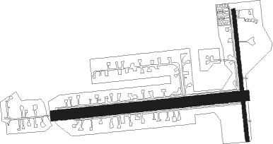
Runway info
Runway 09 / 27  | ||
| length | 855m (2805ft) | |
| bearing | 89° / 269° | |
| width | 46m (150ft) | |
| surface | grass | |
| displ threshold | 79m (259ft) / 62m (203ft) | |
| Runway 18 / 36 | ||
| length | 592m (1942ft) | |
| bearing | 178° / 358° | |
| width | 15m (50ft) | |
| surface | grass | |
| displ threshold | 21m (69ft) / 56m (184ft) | |
Nearby beacons
| code | identifier | dist | bearing | frequency |
|---|---|---|---|---|
| MX | KEDZI (CHICAGO) NDB | 13.8 | 88° | 248 |
| GCO | DME | 16.2 | 20° | 108.25 |
| JOT | JOLIET VOR/DME | 18.1 | 240° | 112.30 |
| DPA | DUPAGE (CHICAGO) VOR/DME | 18.3 | 294° | 108.40 |
| CGT | CHICAGO HEIGHTS VORTAC | 23.4 | 118° | 114.20 |
| EON | PEOTONE VORTAC | 29.3 | 156° | 113.20 |
| OBK | NORTHBROOK VOR/DME | 29.4 | 6° | 113 |
| GY | GARIE (GARY) NDB | 31.6 | 103° | 236 |
| IKK | DME | 40.1 | 167° | 111.60 |
| DTG | DWIGHT NDB | 40.9 | 216° | 344 |
| IK | LUKOW (KANKAKEE) NDB | 43.1 | 172° | 272 |
| UG | WAUKE (CHICAGO/WAUKEGAN) NDB | 44.7 | 15° | 379 |
| ENW | DME | 52.1 | 4° | 109.20 |
| RA | PASER (RACINE) NDB | 57.2 | 6° | 206 |
| BUU | (BURLINGTON) DME | 59 | 342° | 114.50 |
| PNT | PONTIAC VOR/DME | 63.9 | 219° | 109.60 |
Instrument approach procedures
| runway | airway (heading) | route (dist, bearing) |
|---|---|---|
| RWNVA | DPA (114°) | DPA ZURNO (11mi, 148°) 3000ft |
| RNAV | ZURNO 3000ft WEMIB (6mi, 89°) 2400ft LL22 (5mi, 89°) 789ft (5316mi, 115°) 1400ft ZURNO (5327mi, 295°) 3000ft ZURNO (turn) |
Disclaimer
The information on this website is not for real aviation. Use this data with the X-Plane flight simulator only! Data taken with kind consent from X-Plane 12 source code and data files. Content is subject to change without notice.