Rehovot - Tel Nof
Airport details
| Country | Israel |
| State | Center District |
| Region | LL |
| Airspace | Tel Aviv Ctr |
| Municipality | Brener Regional Council |
| Elevation | 191ft (58m) |
| Timezone | GMT +2 |
| Coordinates | 31.83837, 34.81245 |
| Magnetic var | |
| Type | land |
| Available since | X-Plane v10.40 |
| ICAO code | LLEK |
| IATA code | n/a |
| FAA code | n/a |
Communication
| Tel Nof TEL AVIV Approach | 132.000 |
| Tel Nof TEL AVIV Approach | 120.900 |
Nearby Points of Interest:
Givat Brenner Pigeon Coop
-Yesha House
-Sereni House
-Gedera Museum
-Yeshurun Central Synagogue
-Sverdloff Hut
-Rehovot Yosefzon House
-Rehovot Assembly Hall
-White mosque
-Turkish Railway Bridge Over Ela River
-Bet HaTavshil
-London Hotel
-Rishon LeZion old water tower
-Freimann House
-The Arcs bridge over Lachish stream
-The Security Road
-Mikveh Israel
-Etzion grove
-Wilhelma
-Yitzhak Sadeh house
-Negba Open Air Museum
-Sabil Abu Nabbut
-Ali Bibi House
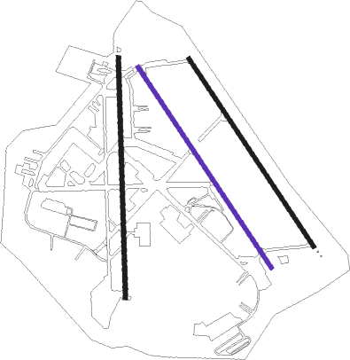
Runway info
Runway 18 / 36  | ||
| length | 2559m (8396ft) | |
| bearing | 183° / 3° | |
| width | 46m (150ft) | |
| surface | asphalt | |
| displ threshold | 150m (492ft) / 0m (0ft) | |
| blast zone | 60m (197ft) / 255m (837ft) | |
| Runway 15R / 33L | ||
| length | 2569m (8428ft) | |
| bearing | 147° / 327° | |
| width | 46m (150ft) | |
| surface | asphalt | |
| displ threshold | 0m (0ft) / 165m (541ft) | |
| blast zone | 255m (837ft) / 255m (837ft) | |
| Runway 15L / 33R | ||
| length | 2404m (7887ft) | |
| bearing | 147° / 327° | |
| width | 46m (150ft) | |
| surface | asphalt | |
| blast zone | 255m (837ft) / 255m (837ft) | |
Nearby beacons
| code | identifier | dist | bearing | frequency |
|---|---|---|---|---|
| BGN | BEN GURION (TEL AVIV) VOR/DME | 10.9 | 20° | 113.50 |
| NAT | NATANIA VOR/DME | 30.8 | 18° | 112.40 |
| BSA | BEER SHEBA VOR/DME | 33.4 | 189° | 114.30 |
| MZD | METZADA VOR/DME | 42.4 | 131° | 115 |
| RMD | RAMAT DAVID NDB | 53.1 | 24° | 368 |
| ARH | EL ARISH VOR/DME | 68 | 232° | 113.60 |
Disclaimer
The information on this website is not for real aviation. Use this data with the X-Plane flight simulator only! Data taken with kind consent from X-Plane 12 source code and data files. Content is subject to change without notice.