Airports for X-Plane offers a convenient way to explore airports and their related communication information for the X-Plane flight simulator. It only uses data from the X-Plane flight simulator itself, and is therefore more reliable than the data that comes from real aviation websites. You can search for airports by using the ICAO code, or browse for airports per country and state. The information displayed is categorized by airport details, runway information, airport communication, approach frequencies (ILS and Glidepath details), details of nearby beacons, SIDs, STARs and approach procedures.

drome helipad newark bus terminal warfare kennedy arrival propeller plane government automated airport weather station arriving outskirts rail transport airport authority immigration rail flight pilot hospital

Ottenschlag

Airport details

CountryAustria
StateLower Austria
RegionLO
AirspaceVienna Ctr
MunicipalityGemeinde Ottenschlag
Elevation2867ft (874m)
TimezoneGMT +1
Coordinates48.41861, 15.21667
Magnetic var
Typeland
Available sinceX-Plane v10.40
ICAO codeLOAA
IATA coden/a
FAA coden/a

Communication

Ottenschlag Ottenschlag Flugplatz122.305
Nearby Points of Interest:
Pfarrkirche Ottenschlag
-
Pfarrkirche Kottes
-
Church of the Assumption (Grainbrunn)
-
Saint Vitus Church
-
Pfarrkirche hl. Martin, Grafenschlag
-
Pfarrkirche Raxendorf
-
Kirchenruine Unterranna
-
Pfarrkirche Heiligenblut
-
Parish church Els
-
St. Petrus und Paulus
-
Schüttkasten Els
-
Burg Albrechtsberg an der Großen Krems
-
Pfarrkirche Großheinrichschlag
-
Pfarrkirche Laimbach am Ostrong
-
Mollenburg´sche Schlosstaverne
-
Pfarrkirche Weiten
-
Schloss Arndorf
-
Schloss Niedernondorf
-
Pfarrkirche Pisching
-
Saint George Church
-
Church of Spitz, Lower Austria
-
Teufelsmauer
-
Wallfahrtskirche Maria Laach
-
Pfarrkirche Weinzierl am Walde
-
Parish church of Niedergrünbach

Runway info

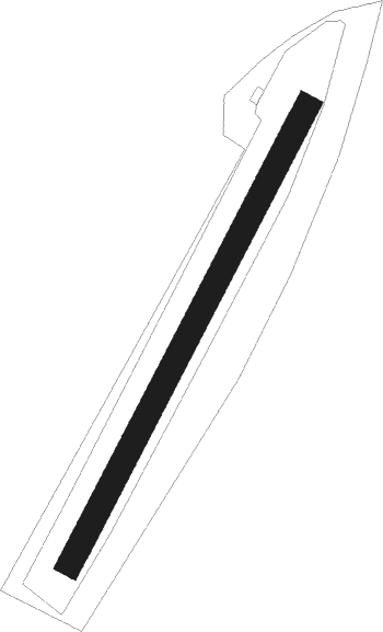
Runway 03 / 21
 length517m (1696ft)
 bearing43° / 223°
 width25m (82ft)
 surfacegrass

Airport layout


Nearby beacons

codeidentifierdistbearingfrequency
TUNTULLN NDB31.198°358
STOSTOCKERAU VOR/DME31.990°113
OKFDESNA VOR/DME35.531°113.15
LNZLINZ NDB37.3259°327
LNAMEST NDB57.552°362
LANAMEST NDB57.553°514
XNAMEST NDB57.549°362
XUNAMEST NDB57.548°563

Disclaimer

The information on this website is not for real aviation. Use this data with the X-Plane flight simulator only! Data taken with kind consent from X-Plane 12 source code and data files. Content is subject to change without notice.