Airports for X-Plane offers a convenient way to explore airports and their related communication information for the X-Plane flight simulator. It only uses data from the X-Plane flight simulator itself, and is therefore more reliable than the data that comes from real aviation websites. You can search for airports by using the ICAO code, or browse for airports per country and state. The information displayed is categorized by airport details, runway information, airport communication, approach frequencies (ILS and Glidepath details), details of nearby beacons, SIDs, STARs and approach procedures.

station concrete port airport authority embassy bus nearby airdock airbase runway lighting aerodromes stolport passenger city runway automated airport weather station rail government hangar airport terminal

Völtendorf

Airport details

CountryAustria
StateLower Austria
RegionLO
AirspaceVienna Ctr
MunicipalityGemeinde Ober-Grafendorf
Elevation1063ft (324m)
TimezoneGMT +1
Coordinates48.16056, 15.58750
Magnetic var
Typeland
Available sinceX-Plane v10.40
ICAO codeLOAD
IATA coden/a
FAA coden/a

Communication

Völtendorf Völtendorf Flugplatz125.605
Nearby Points of Interest:
Church of St. Georgen am Steinfelde
-
Spinnerei Harland
-
Kalvarienberg (St. Pölten)
-
Stattersdorf
-
Voithvilla
-
Pfarrkirche hl. Johannes der Täufer, Gerersdorf
-
Mahnmal für die Widerstandsgruppe Kirchl-Trauttmansdorff
-
Hesserkaserne
-
BRG & BORG St. Pölten
-
St. Pölten Town hall
-
Stadtsäle
-
St. Pölten synagogue
-
Apotheke Zum Goldenen Löwen (St. Pölten)
-
Stöhr- oder Olbrichhaus
-
Karl Landsteiner University Hospital St. Pölten
-
Pfarrkirche Wagram
-
Glanzstoff Austria
-
Pfarrkirche St. Margarethen an der Sierning
-
Kirche Zum guten Hirten
-
Pfarrkirche hl. Zeno, Hafnerbach
-
Pfarrkirche Bischofstetten
-
Schloss Karlstetten
-
Schloss Zagging
-
Pfarrkirche Rabenstein an der Pielach
-
Banntaiding der Pfarrherrschaft Obritzberg

Runway info

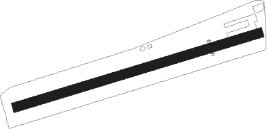
Runway 08 / 26
 length645m (2116ft)
 bearing82° / 262°
 width25m (82ft)
 surfacegrass
 displ threshold75m (246ft) / 75m (246ft)

Airport layout


Nearby beacons

codeidentifierdistbearingfrequency
TUNTULLN NDB1869°358
STOSTOCKERAU VOR/DME23.159°113
STESTEINHOF NDB26.586°293
SNUSOLLENAU VOR/DME32.9112°115.50
WGMWAGRAM VOR/DME37.480°112.20
OKFDESNA VOR/DME48.5357°113.15
RAWDME53.3168°112.15
LANAMEST NDB63.131°514
LNAMEST NDB63.530°362
ZWZELTWEG NDB66.8221°418

Disclaimer

The information on this website is not for real aviation. Use this data with the X-Plane flight simulator only! Data taken with kind consent from X-Plane 12 source code and data files. Content is subject to change without notice.