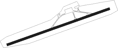
Airports for X-Plane offers a convenient way to explore airports and their related communication information for the X-Plane flight simulator. It only uses data from the X-Plane flight simulator itself, and is therefore more reliable than the data that comes from real aviation websites. You can search for airports by using the ICAO code, or browse for airports per country and state. The information displayed is categorized by airport details, runway information, airport communication, approach frequencies (ILS and Glidepath details), details of nearby beacons, SIDs, STARs and approach procedures.

jetliner airbase airdock landing airport terminal non-towered airport runway airport apron asphalt aviation seaplanes air traffic control gravel station aerodromes metro control tower luggage faa consulate

Stockerau

Airport details

CountryAustria
StateLower Austria
RegionLO
AirspaceVienna Ctr
MunicipalityGemeinde Stockerau
Elevation685ft (209m)
TimezoneGMT +1
Coordinates48.41000, 16.19167
Magnetic var
Typeland
Available sinceX-Plane v10.40
ICAO codeLOAU
IATA coden/a
FAA coden/a

Communication

No airport communication available for LOAU
Nearby Points of Interest:
Monastery St. Koloman (Stockerau)
-
Wohnhaus, ehem. Bürgerspital
-
Dreifaltigkeitssäule in Stockerau
-
Niembsch-Hof in Stockerau
-
Pfarrkirche Kleinwilfersdorf
-
Schloss Schönborn (Göllersdorf)
-
Villa Pereira
-
Pfarrkirche Höflein an der Donau
-
Pfarrkirche St Andrä vor dem Hagental
-
Justizanstalt Göllersdorf
-
Wielandsdorf
-
Bergau Pfarrkirche
-
Pfarr- und Wallfahrtskirche Maria Gugging
-
Korneuburg Schiffswerft
-
Pfarrkirche Kritzendorf
-
Großstelzendorf Kirche
-
Rathaus Korneuburg
-
Kierlinger Pfarrkirche
-
Pfarrkirche St. Stephan, Tulln
-
Wasserkapelle
-
Comagena
-
parish church Obergänserndorf
-
Jewish cemetery Tulln
-
St. Martinskirche
-
Rostock-Villa

Runway info

Runway 07 / 25
 length801m (2628ft)
 bearing80° / 260°
 width18m (59ft)
 surfaceasphalt
 displ threshold0m (0ft) / 180m (591ft)

Airport layout


Taxiway locations
Parking locations

Nearby beacons

codeidentifierdistbearingfrequency
STOSTOCKERAU VOR/DME6.9272°113
TUNTULLN VOR/DME10.3245°111.40
TUNTULLN NDB10.4244°358
STESTEINHOF NDB12.1164°293
WGMWAGRAM VOR/DME13106°112.20
FMDFISCHAMEND VOR/DME25.3125°110.40
BRKBRUCK NDB29.5123°408
SNUSOLLENAU VOR/DME32.3170°115.50
OKFDESNA VOR/DME42.2311°113.15
LANAMEST NDB43.6359°514
LNAMEST NDB44.4357°362
XNAMEST NDB46.4353°362
XUNAMEST NDB47.5351°563
BNOBRNO VOR/DME48.634°114.45
BBOREK (BRNO) NDB49.136°429

Disclaimer

The information on this website is not for real aviation. Use this data with the X-Plane flight simulator only! Data taken with kind consent from X-Plane 12 source code and data files. Content is subject to change without notice.