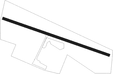
Trieben
Airport details
| Country | Austria |
| State | Styria |
| Region | LO |
| Airspace | Vienna Ctr |
| Municipality | Trieben |
| Elevation | 2286ft (697m) |
| Timezone | GMT +1 |
| Coordinates | 47.49361, 14.49667 |
| Magnetic var | |
| Type | land |
| Available since | X-Plane v10.40 |
| ICAO code | LOGI |
| IATA code | n/a |
| FAA code | n/a |
Communication
| Trieben Trieben Flugplatz | 122.500 |
Nearby Points of Interest:
Schloss Kaiserau
-Höhensiedlung Kaiserköpperl
-Admont Abbey
-Ehemaliges Augustinerchorherrenstift Rottenmann
-Rathaus Rottenmann
-Pfarrkirche hll. Kosmas und Damian, Weng im Gesäuse
-Glaubenskirche (St. Johann am Tauern)
-Pfarrkirche Unterwald
-Pfarrkirche Bretstein
-Kollegiatstift Spital am Pyhrn
-Schüttkasten Weißenbach an der Enns
-Brücke von Oberzeiring
-Filialkirche hl. Elisabeth, Oberzeiring
-Pfarrkirche hl. Jakob, Windischgarsten
-Schwarzer Hof, Eisenerz
-Schloss Gusterheim
-Eisenerzer Bahn
-Schloss Sauerbrunn
-Pfarrhof Fohnsdorf
-Gemeindeamt Fohnsdorf
-Filialkirche Seiz
-Kohlebergwerk Wodzicki
-Ortskapelle Aichdorf
-Filialkirche Brunnbach
-Pankratiuskirche (Oberwölz)
Nearby beacons
| code | identifier | dist | bearing | frequency |
|---|---|---|---|---|
| ZW | ZELTWEG NDB | 20.6 | 139° | 418 |
| LNZ | LINZ NDB | 45.2 | 347° | 327 |
| KOR | DME | 46.6 | 146° | 109.40 |
| LNZ | LINZ VOR/DME | 46.9 | 332° | 116.60 |
| GRZ | GRAZ VOR/DME | 50.5 | 119° | 116.20 |
| KI | KLAGENFURT NDB | 51.8 | 188° | 313 |
| KFT | KLAGENFURT NDB | 52.1 | 178° | 374 |
| GRZ | GRAZ NDB | 52.2 | 121° | 290 |
| VIW | DME | 53.4 | 216° | 112.90 |
| KFT | KLAGENFURT VOR/DME | 53.8 | 176° | 113.10 |
| FRE | DME | 58.2 | 339° | 113.50 |
Disclaimer
The information on this website is not for real aviation. Use this data with the X-Plane flight simulator only! Data taken with kind consent from X-Plane 12 source code and data files. Content is subject to change without notice.