Airports for X-Plane offers a convenient way to explore airports and their related communication information for the X-Plane flight simulator. It only uses data from the X-Plane flight simulator itself, and is therefore more reliable than the data that comes from real aviation websites. You can search for airports by using the ICAO code, or browse for airports per country and state. The information displayed is categorized by airport details, runway information, airport communication, approach frequencies (ILS and Glidepath details), details of nearby beacons, SIDs, STARs and approach procedures.

aerodrome airport terminal jet frankfurt airport passengers government stol field train takeoff warfare international rail transport corporation grass control tower flights taxi airspeed concrete

Mariazell

Airport details

CountryAustria
StateStyria
RegionLO
AirspaceVienna Ctr
MunicipalityMariazell
Elevation2819ft (859m)
TimezoneGMT +1
Coordinates47.78944, 15.30028
Magnetic var
Typeland
Available sinceX-Plane v10.40
ICAO codeLOGM
IATA coden/a
FAA coden/a

Communication

Mariazell Mariazell Flugplatz122.105
Nearby Points of Interest:
Pfarrkirche Gußwerk
-
Pfarrkirche Josefsberg
-
Pfarrkirche Annaberg
-
Filialkirche Greith
-
Kath. Filialkirche Mariae Heimsuchung
-
Dürrenstein
-
Brandhof
-
Hochschwab Straße
-
Grassermühle
-
Pfarrkirche Frankenfels
-
Peutenburger Felsen
-
Wasserleitungskraftwerk Gaming
-
Die Not
-
Villa, sog. Schloss Lehenhof
-
Wohnhaus, ehem. Pfarrkirche hl. Anna
-
Schloss Scheibbs
-
Klosterkirche St. Barbara
-
Pfarrkirche Plankenstein
-
Landesklinikum Scheibbs
-
Hammerherrenhaus Wildalpen
-
Pfarrkirche Göstling an der Ybbs
-
Pfarrkirche Kirchberg an der Pielach
-
Filialkirche Tradigist
-
Saint Nicholas Church
-
Evang. Friedhof mit Friedhofskapelle

Runway info

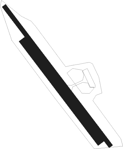
Runway 15 / 33  
 length699m (2293ft)
 bearing136° / 316°
 width18m (59ft)
 surfaceasphalt
 displ threshold157m (515ft) / 40m (131ft)
Runway 15R / 33L  
 length499m (1637ft)
 bearing136° / 316°
 width30m (98ft)
 surfacegrass

Airport layout


Parking locations

Nearby beacons

codeidentifierdistbearingfrequency
RAWDME36137°112.15
SNUSOLLENAU VOR/DME40.185°115.50
TUNTULLN NDB41.453°358
ZWZELTWEG NDB41.8223°418
STESTEINHOF NDB45.666°293
STOSTOCKERAU VOR/DME47.449°113
LNZLINZ NDB47.6295°327
GRZGRAZ VOR/DME50.4170°116.20
GRZGRAZ NDB52.5170°290
GBGGLEICHENBERG NDB57.8151°426
STKKOGEL DME62.2146°114.55

Disclaimer

The information on this website is not for real aviation. Use this data with the X-Plane flight simulator only! Data taken with kind consent from X-Plane 12 source code and data files. Content is subject to change without notice.