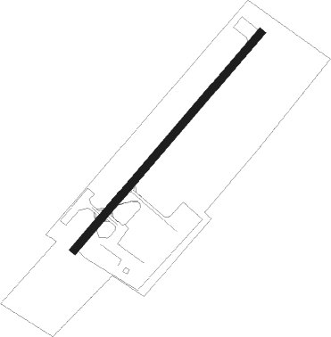
Airports for X-Plane offers a convenient way to explore airports and their related communication information for the X-Plane flight simulator. It only uses data from the X-Plane flight simulator itself, and is therefore more reliable than the data that comes from real aviation websites. You can search for airports by using the ICAO code, or browse for airports per country and state. The information displayed is categorized by airport details, runway information, airport communication, approach frequencies (ILS and Glidepath details), details of nearby beacons, SIDs, STARs and approach procedures.

public transport automated airport weather station flight international airdock buildings seaplane embassy military flight attendant ferry road jet nearby airfield luggage metro air traffic control helicopters air terminal

Hohenems / Dornbirn - Hohenems Dornbirn

Airport details

CountryAustria
StateVorarlberg
RegionLO
AirspaceVienna Ctr
MunicipalityStadt Hohenems
Elevation1352ft (412m)
TimezoneGMT +1
Coordinates47.38500, 9.70000
Magnetic var
Typeland
Available sinceX-Plane v10.40
ICAO codeLOIH
IATA codeHOH
FAA coden/a

Communication

Hohenems Dornbirn Hohenems Flugplatz121.205
Nearby Points of Interest:
Richtstätte
-
Rochuskapelle
-
Parish church Dornbirn-Schoren
-
Parish church Dornbirn-Hatlerdorf
-
Adolf-Rhomberg-Haus
-
Kapelle Zu den Sieben Schmerzen Mariä (Vorderachmühle)
-
Feurstein-Haus
-
Lorenz-Rhomberg-Haus
-
Klostergasse 1
-
Villa Hämmerle (Dornbirn)
-
Parish church Dornbirn-Rohrbach
-
Schlossguggerhaus
-
Pfarrkirche Hl. Maria Magdalena, Ebnit
-
Town hall
-
Tankstelle im Kobel
-
Kapelle Maria Schnee, Kehlegg
-
Villa Schmidheiny
-
Kapelle Hl. Ottilie
-
Villa Robert Bösch
-
Senderbrücke
-
Pfarrkirche hl. Ulrich
-
Pfarrkirche Fraxern
-
Lourdeskapelle, Kapellenstraße in Schwarzach
-
Mariahilfkapelle
-
Ansitz, Birkach

Runway info

Runway 05 / 23
 length635m (2083ft)
 bearing56° / 236°
 width18m (59ft)
 surfaceasphalt
 displ threshold33m (108ft) / 0m (0ft)

Airport layout


Parking locations

Nearby beacons

codeidentifierdistbearingfrequency
FHDDME18.7325°112.60
WFJDME33.2170°113.75
KPTKEMPTEN VOR/DME34.161°108.40
ZUEZURICH EAST VOR/DME37.9283°110.05
ALD(MEMMINGEN/ALLGAU) DME42.141°117.20
ALGALLGAEU (MEMMINGEN) NDB43.243°341
LUPLAUPHEIM NDB50.714°407
CVADME58.2173°112.05

Disclaimer

The information on this website is not for real aviation. Use this data with the X-Plane flight simulator only! Data taken with kind consent from X-Plane 12 source code and data files. Content is subject to change without notice.